- Usage in publication:
-
- Rhodes Canyon formation
- Modifications:
-
- First used
- Dominant lithology:
-
- Shale
- AAPG geologic province:
-
- Orogrande basin
Summary:
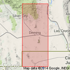
First[?] published use as a name for a formation that lies between the Thoroughgood Formation and the Contadero Formation. Intent to name, source of name, and designation of a type not stated. Consists of 75 ft of soft shale. The lower part is white and marly; the middle part is silty; the upper part has soft clay shale. [The locality of Rhodes Canyon is in the San Andres Mountains, Sierra Co, NM in the Orogrande basin.]
Source: GNU records (USGS DDS-6; Denver GNULEX).

- Usage in publication:
-
- Rhodes Canyon Formation*
- Modifications:
-
- Overview
- AAPG geologic province:
-
- Orogrande basin
Summary:
Type section stated to be in Rhodes Canyon, San Andres Mountains, Sierra Co., NM in the Orogrande basin where it overlies a thin remnant of the Thoroughgood Formation. Has been identified also in Ash Canyon in the southern San Andres Mountains in Dona Ana Co. Unconformably overlain by the Mississippian Lake Valley or Caballero Formations. Correlates with part or all of the Ready Pay Member of the Percha Formation. Probably is the more shoreward facies of the Ready Pay. Brachiopods common. Eleven genera and 16 species identified. The brachiopods are Famennian age, probably middle Famennian. Correlation charts. Cross sections.
Source: GNU records (USGS DDS-6; Denver GNULEX).

- Usage in publication:
-
- Rhodes Canyon Member
- Modifications:
-
- Revised
- Areal extent
- Overview
- AAPG geologic province:
-
- Orogrande basin
Summary:
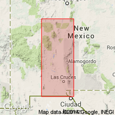
Reduced in stratigraphic rank from Rhodes Canyon Formation to Rhodes Canyon Member, upper member of the Contadero Formation. Overlies Thurgood Sandstone Member (spelling of place name and stratigraphic rank revised) of Contadero conformably. Recognized with certainty in Cottonwood, Rhodes, and Mackinson Canyons, and on Salinas Peak, in the northern San Andres Mountains, Sierra Co, NM in the Orogrande basin, an areal extent of 11 to 12 miles. Consists of green to tan shale with thin burrowed siltstone. Increases in thickness from Salinas Peak where it is 6.8 m thick to Cottonwood Canyon where it is 21 m thick. Underlies Mississippian Lake Valley Formation. Correlated with the Ready Pay Member of Percha Formation. Has a brachiopod fauna of middle Fammenian, Late Devonian age. Correlation chart; cross section; geologic map.
Source: GNU records (USGS DDS-6; Denver GNULEX).
For more information, please contact Nancy Stamm, Geologic Names Committee Secretary.
Asterisk (*) indicates published by U.S. Geological Survey authors.
"No current usage" (†) implies that a name has been abandoned or has fallen into disuse. Former usage and, if known, replacement name given in parentheses ( ).
Slash (/) indicates name conflicts with nomenclatural guidelines (CSN, 1933; ACSN, 1961, 1970; NACSN, 1983, 2005, 2021). May be explained within brackets ([ ]).

