

- Usage in publication:
-
- Reynolds Basin Group
- Modifications:
-
- Named
- Dominant lithology:
-
- Basalt
- Tuff
- Latite
- Gravel
- Sand
- AAPG geologic province:
-
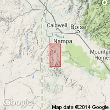
- Snake River basin
Summary:
Named; derivation of name not given, and no type locality designated. Is an intertonguing sequence of olivine basalt flows, silicic tuff, diatomites, arkosic sands and granitic gravels, and felsitic to glassy flows of latite. The group of rocks, viewed as a whole, is overlain by angular unconformities characterized by considerable erosional relief; rock units in the group are mutually intertonguing, making relative age ranking of units within group impossible. Rocks of the group overlies discordantly tilted and eroded fault-bounded blocks of Salmon Creek Volcanics and were, in turn, deformed and channeled prior to deposition of the Pliocene rhyolitic ash-flow tuff. Group contains (very loosely in ascending order, and all new names): Hoot Nanny Olivine Basalt; Soldier Cap Olivine Basalt; tuff associated with lower latite unit; glassy portion of lower latite unit; felsitic portion of lower latite unit; Toll Gate Olivine Basalt; tuff associated with upper latite unit; glassy portion of upper latite unit; felsitic portion of upper latite unit; Boston Ranch unit/Formation [author uses both terms interchangeably]; rhyolite of Silver City Mining District; and arkosic unit. Maximum aggregate thickness of the group is not very meaningful, because only a few of the units are present at any one place. Only rarely does the thickness at any one place exceed 1,000 ft. Group is probably late Miocene or early Pliocene in age.
Source: GNU records (USGS DDS-6; Denver GNULEX).
For more information, please contact Nancy Stamm, Geologic Names Committee Secretary.
Asterisk (*) indicates published by U.S. Geological Survey authors.
"No current usage" (†) implies that a name has been abandoned or has fallen into disuse. Former usage and, if known, replacement name given in parentheses ( ).
Slash (/) indicates name conflicts with nomenclatural guidelines (CSN, 1933; ACSN, 1961, 1970; NACSN, 1983, 2005, 2021). May be explained within brackets ([ ]).