- Usage in publication:
-
- Resolution dolomite member*
- Modifications:
-
- Named
- Dominant lithology:
-
- Dolomite
- Shale
- Grit
- AAPG geologic province:
-
- Eagle basin
Summary:
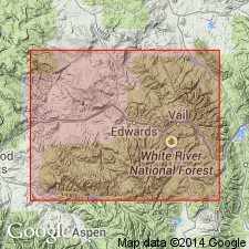
Named as a member of Minturn formation for Resolution Mountain, Eagle Co, CO in Eagle basin. No type locality designated though measured section on Resolution Mountain described. Composed of lower dolomite 35 to 40 ft thick, middle shale and grit 15 to 35 ft thick, and an upper dolomite 15 to 22 ft thick. Is 3,700 ft above Belden-Minturn contact. Overlies a massive, cross-bedded, gray to yellow and green conglomeratic grit of the Minturn; underlies grayish clastic rocks of the Minturn. Includes several dolomite reefs that contain CHAETETES and abundant crinoid fragments. Is of Pennsylvanian age.
Source: GNU records (USGS DDS-6; Denver GNULEX).
For more information, please contact Nancy Stamm, Geologic Names Committee Secretary.
Asterisk (*) indicates published by U.S. Geological Survey authors.
"No current usage" (†) implies that a name has been abandoned or has fallen into disuse. Former usage and, if known, replacement name given in parentheses ( ).
Slash (/) indicates name conflicts with nomenclatural guidelines (CSN, 1933; ACSN, 1961, 1970; NACSN, 1983, 2005, 2021). May be explained within brackets ([ ]).

