The National Geologic Map Database is migrating to a new infrastructure. We apologize for any service disruptions during this process.
|
|---|


- Usage in publication:
-
- Resendez shale member
- Modifications:
-
- Named
- Dominant lithology:
-
- Shale
- AAPG geologic province:
-
- Gulf Coast basin
Summary:
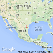
Named as member in lower part of Fayette formation in Starr Co, TX (Gulf Coast basin). Type locality not designated. "Above the Salineno sandstone there was laid down a series of shaly beds with local developments of argillaceous sandstone and oyster streaks. It is here proposed to call this member the Resendez member of the Fayette from the Resendez ranch house, 1 mile northwest of Roma, Roma Quadrangle. In the Roma area, the shales are characterized by a very abundant assemblage of Foraminifera and Ostracoda as well as megascopic shells. The top of these shales in contact with the base of the Roma sandstone may be observed approximately 1 mile north of Roma, on the first road west, and 0.2 mile west of the paved Laredo-Roma highway. Here in Arroyo De Los Negros and in tributary gullies are outcrops where the different beds of the Resendez member of the Fayette may be studied. Oyster beds are well developed, and the very robust OSTREA GEORGIANA is present, which attains 12 inches in length. This Resendez shale member is about 80 feet thick throughout the Roma area but *** it apparently grades northward into nonmarine bentonitic red and green shale." Overlies Salineno sandstone tongue of the Fayette; underlies Roma sandstone tongue of Fayette. Assigned to the Eocene. Cross section from Laredo to Rio Grande City (fig 2). Locality map.
Source: GNU records (USGS DDS-6; Denver GNULEX).
For more information, please contact Nancy Stamm, Geologic Names Committee Secretary.
Asterisk (*) indicates published by U.S. Geological Survey authors.
"No current usage" (†) implies that a name has been abandoned or has fallen into disuse. Former usage and, if known, replacement name given in parentheses ( ).
Slash (/) indicates name conflicts with nomenclatural guidelines (CSN, 1933; ACSN, 1961, 1970; NACSN, 1983, 2005, 2021). May be explained within brackets ([ ]).