- Usage in publication:
-
- Renegade Tongue*
- Modifications:
-
- Named
- Dominant lithology:
-
- Sandstone
- Shale
- Siltstone
- AAPG geologic province:
-
- Uinta basin
Summary:
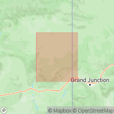
Named for exposures near Renegade Canyon in vicinity of T19S, R20E, Grand Co, eastern UT in Uinta basin. Type section (composite) designated at secs 33 and 34, T18S, R20E and at secs 18 and 19, T19S, R20E; detailed columnar section E shown on Plate 3. Forms upper part of Wasatch Formation and intertongues with Douglas Creek Member of Green River Formation. Consists of massive, irregularly bedded brown and gray sandstones and red and gray shales and siltstones. Is 1000 ft thick at type locality, but thins northward owing to intertonguing with Douglas Creek Member. Northwest of line projected about parallel to Tenmile Canyon (T16S, R21E), is divided into informal units W (upper) and X (lower) separated by tongues of Green River Formation. Unit X is mostly a red and gray shale and extends east of mapped area. Unit X is 7 ft thick at White River, but thickens north and southwest; Unit W is a poorly bedded sandstone and can be traced northeastward to Park Canyon (T11S, R25E). Dominantly fluvial rocks of Renegade contrast with dominantly lacustrine rocks of Green River Formation. Geologic map, columnar sections fence, and stratigraphic correlation diagrams. Is of probable middle Eocene age. Conformably overlies tongue D of Douglas Creek Member of Green River Formation, and conformably overlain by tongue A of Douglas Creek Member.
Source: GNU records (USGS DDS-6; Denver GNULEX).
For more information, please contact Nancy Stamm, Geologic Names Committee Secretary.
Asterisk (*) indicates published by U.S. Geological Survey authors.
"No current usage" (†) implies that a name has been abandoned or has fallen into disuse. Former usage and, if known, replacement name given in parentheses ( ).
Slash (/) indicates name conflicts with nomenclatural guidelines (CSN, 1933; ACSN, 1961, 1970; NACSN, 1983, 2005, 2021). May be explained within brackets ([ ]).

