

- Usage in publication:
-
- Reliz Canyon Formation*
- Modifications:
-
- Named
- Biostratigraphic dating
- Dominant lithology:
-
- Sandstone
- Siltstone
- AAPG geologic province:
-
- California Coast Ranges province
Summary:
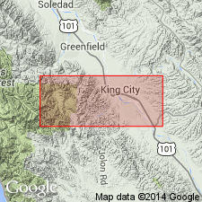
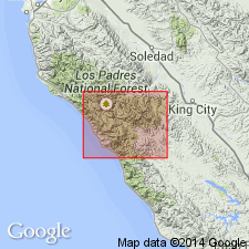
Named for exposures in upper Reliz Canyon, Reliz Canyon 7.5' quad, Monterey Co, CA, designated as its type locality. Extends from center of Reliz Canyon 7.5' quad to southwestern part of Thompson Canyon 7.5' quad. Divided into: lower member (180 ft thick) of fine- to coarse-grained arkosic sandstone, locally conglomeratic near base; middle member (350 ft thick) of mainly massive siltstone; and upper member (about 1400 ft thick) of massive medium- to coarse-grained arkosic sandstone interbedded with thin units of finer grained sandstone. Measured sections of members included in report. Unconformably overlies pre-Tertiary basement complex; underlies Vaqueros Formation. Considered to be Eocene in age on basis of foraminifers in middle member.
Source: GNU records (USGS DDS-6; Menlo GNULEX).
- Usage in publication:
-
- Reliz Canyon Formation*
- Modifications:
-
- Revised
- Age modified
- Biostratigraphic dating
- AAPG geologic province:
-
- California Coast Ranges province
Summary:
Junipero Sandstone, Lucia Shale, and The Rocks Sandstone, all of Thorup (1943) reduced in rank and adopted in ascending order as Junipero Sandstone, Lucia Mudstone, and The Rocks Sandstone Members, respectively, of Reliz Canyon Formation. Age of Reliz Canyon Formation in area of report [Ventana Wilderness and adjacent roadless areas] is late Paleocene to middle Eocene on basis of late Paleocene calcareous algae (Graham, 1979) and early to middle Eocene foraminifers.
Source: GNU records (USGS DDS-6; Menlo GNULEX).
For more information, please contact Nancy Stamm, Geologic Names Committee Secretary.
Asterisk (*) indicates published by U.S. Geological Survey authors.
"No current usage" (†) implies that a name has been abandoned or has fallen into disuse. Former usage and, if known, replacement name given in parentheses ( ).
Slash (/) indicates name conflicts with nomenclatural guidelines (CSN, 1933; ACSN, 1961, 1970; NACSN, 1983, 2005, 2021). May be explained within brackets ([ ]).