The National Geologic Map Database is migrating to a new infrastructure. We apologize for any service disruptions during this process.
|
|---|


- Usage in publication:
-
- Reed Canyon silt member
- Modifications:
-
- Named
- Biostratigraphic dating
- Dominant lithology:
-
- Silt
- AAPG geologic province:
-
- Transverse Ranges province
Summary:
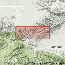
Named as uppermost member (of 4) of Tejon formation. Type locality designated as Reed Canyon, Tehachapi Mountains in type locality of Tejon formation. Thickness is 160 ft. Unconformably underlies continental deposits of Oligocene and Miocene age; overlies Metralla sandstone member (new) of Tejon formation. Age is Eocene based on ECTINOCHILUS ELONGATUS, TURRITELLA SCHENCK, DISCOCYCLINA sp. nov., UVIGERINA cf. COCOAENSIS.
Source: GNU records (USGS DDS-6; Menlo GNULEX).
- Usage in publication:
-
- Reed Canyon silt member
- Modifications:
-
- Age modified
- AAPG geologic province:
-
- Transverse Ranges province
Summary:
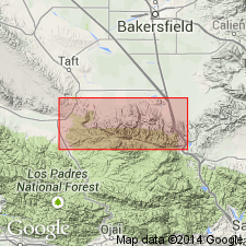
At type locality in Reed Canyon consists of 160 feet of fine-grained sedimentary deposits, grading from very fine sandstone at base to silt which contains considerable glauconite 35 feet below top surface. Upper 20 feet consist of buff-weathering, unfossiliferous shale. Distinguished by fine-grained texture and dark-gray color. Shown on stratigraphic column as unconformably underlying Tecuya formation. Age is late Eocene on basis of preliminary faunal study.
Source: GNU records (USGS DDS-6; Menlo GNULEX).
- Usage in publication:
-
- Reed Canyon Siltstone Member*
- Modifications:
-
- Adopted
- Redescribed
- AAPG geologic province:
-
- Transverse Ranges province
Summary:
Reed Canyon Silt Member (Marks, 1941) adopted as Reed Canyon Siltstone Member of Tejon Formation. Locally contains shallow marine megafauna as well as thin layers of coal and other carbonaceous debris; probably deposited in variety of shallow marine and brackish-water environments including lagoons behind offshore bars or islands. Age is Eocene.
Source: GNU records (USGS DDS-6; Menlo GNULEX).
- Usage in publication:
-
- Reed Canyon Siltstone Member*
- Modifications:
-
- Age modified
- AAPG geologic province:
-
- Transverse Ranges province
Summary:
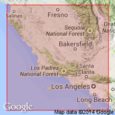
Is less than 200 ft thick. West of Reed Canyon overlies Metralla Sandstone Member (Tejon Formation); near Salt Creek may grade laterally into middle shale unit of overlying San Emigdio Formation. Foraminifers suggest Narizian age. Locally contains mollusks indicative of shallow marine environment.
Source: GNU records (USGS DDS-6; Menlo GNULEX).
- Usage in publication:
-
- Reed Canyon Siltstone Member*
- Modifications:
-
- Age modified
- AAPG geologic province:
-
- Transverse Ranges province
Summary:
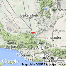
Measured type section (104 ft thick) designated as exposures 0.5 mi south of mouth of Reed Canyon, E/2 sec.25 T10N R20W Grapevine 7.5' quad, Kern Co, CA. Crops out discontinuously between Black and Metralla Canyons but is absent elsewhere, or if present, has been mapped as upper part of underlying Metralla Sandstone Member (Tejon Formation) or lower part of San Emigdio Formation. Considered to be middle and late(?) Eocene age based on fossils of late Narizian and Refugian(?) age.
Source: GNU records (USGS DDS-6; Menlo GNULEX).
For more information, please contact Nancy Stamm, Geologic Names Committee Secretary.
Asterisk (*) indicates published by U.S. Geological Survey authors.
"No current usage" (†) implies that a name has been abandoned or has fallen into disuse. Former usage and, if known, replacement name given in parentheses ( ).
Slash (/) indicates name conflicts with nomenclatural guidelines (CSN, 1933; ACSN, 1961, 1970; NACSN, 1983, 2005, 2021). May be explained within brackets ([ ]).