The National Geologic Map Database is migrating to a new infrastructure. We apologize for any service disruptions during this process.
|
|---|


- Usage in publication:
-
- Redrock Canyon sandstone member*
- Modifications:
-
- Named
- Dominant lithology:
-
- Sandstone
- Clay
- Conglomerate
- AAPG geologic province:
-
- California Coast Ranges province
Summary:
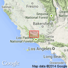
Redrock Canyon sandstone member named as basal member of Santa Margarita Formation for its limited occurrence in Redrock Canyon, Cuyama Valley [Caliente Mountain 15' quad], southwestern San Luis Obispo Co, CA. Consists of bright-red sandstone, clay, and conglomerate, having thickness of 500 ft. Unconformably overlies pre-Monterey rocks. Conformably underlies Whiterock Bluff shale member (new) of Santa Margarita Formation. Age given as Miocene on map legend.
Source: GNU records (USGS DDS-6; Menlo GNULEX).
For more information, please contact Nancy Stamm, Geologic Names Committee Secretary.
Asterisk (*) indicates published by U.S. Geological Survey authors.
"No current usage" (†) implies that a name has been abandoned or has fallen into disuse. Former usage and, if known, replacement name given in parentheses ( ).
Slash (/) indicates name conflicts with nomenclatural guidelines (CSN, 1933; ACSN, 1961, 1970; NACSN, 1983, 2005, 2021). May be explained within brackets ([ ]).