

- Usage in publication:
-
- Redoak Hollow sandstone member
- Modifications:
-
- Named
- Dominant lithology:
-
- Sandstone
- AAPG geologic province:
-
- South Oklahoma folded belt
Summary:
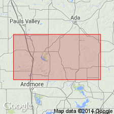
Named as middle member of Goddard shale; named from Redoak Hollow, a westward-draining valley in the S1/2 sec 19, T2S, R1W, Carter Co, OK, S. Oklahoma folded belt province. The key map showing type localities of new stratigraphic units shows sec 30, T2S, R1W as type locality for the unit. In footnote on p. 70 for the stratigraphic table, Elias states, based on further review of the evidence, that he now believes this unit may belong in lower part of Goddard shale. Occurs in the southern Arbuckle Mountains of south-central OK. Consists of richly fossiliferous sandstone about 2 ft thick in an area about 3 mi north of Milo. Most important and largest fauna from Goddard shale comes from four localities within Redoak Hollow. Lies 550-600 ft above the base of Goddard shale and about 1,000 ft below the occurrence of EUMORPHOCERAS. Lies between upper part and lower part of Goddard shale. Stratigraphic table; geologic map; fossil lists (mostly bryozoans, some brachiopods). May include Goodwin sandstone of the subsurface. Of Mississippian (Chester) age.
Source: GNU records (USGS DDS-6; Denver GNULEX).
For more information, please contact Nancy Stamm, Geologic Names Committee Secretary.
Asterisk (*) indicates published by U.S. Geological Survey authors.
"No current usage" (†) implies that a name has been abandoned or has fallen into disuse. Former usage and, if known, replacement name given in parentheses ( ).
Slash (/) indicates name conflicts with nomenclatural guidelines (CSN, 1933; ACSN, 1961, 1970; NACSN, 1983, 2005, 2021). May be explained within brackets ([ ]).