The National Geologic Map Database is migrating to a new infrastructure. We apologize for any service disruptions during this process.
|
|---|


- Usage in publication:
-
- Redfield formation
- Modifications:
-
- Original reference
- Dominant lithology:
-
- Silt
- Clay
- Sand
- AAPG geologic province:
-
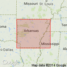
- Desha basin
Wilbert, L.J., Jr., 1953, The Jacksonian Stage in southeastern Arkansas: Arkansas Division of Geology Bulletin, no. 19, __ p.
Summary:
Pg. 80-87. Redfield formation. Embraces the nonmarine Jacksonian deposits which overlie and are partially equivalent to the White Bluff formation. From north to south, the Redfield successively overlies the Pastoria and Rison members (both new) of the White Bluff; boundary is an erosion surface which is either subaerially exposed or is overlain by Pleistocene terrace deposits. Estimated maximum thickness 150 to 200 feet. Age is late Eocene (Jacksonian).
Named from village of Redfleld in northern Jefferson Co., southeastern AR. Well exposed at White Bluff, 4 mi east of the village. Formation is restricted to northem part of Jacksonian outcrop area.
Source: US geologic names lexicon (USGS Bull. 1200, p. 3220); Arkansas Strat. Sum. (McFarland, 2004, Jackson entry p. 34).
- Usage in publication:
-
- Redfield Formation
- Modifications:
-
- Overview
- Dominant lithology:
-
- Silt
- Clay
- Sand
- AAPG geologic province:
-
- Desha basin
Summary:
Pg. 34 (Jackson entry). Redfield Formation, upper nonmarine unit in Jackson Group. Typically a sequence of light gray, thinly laminated silts, silty clays, and silty sands. Cross-bedded sands and minor lignite beds have been noted and plant remains are generally abundant. Overlies marine White Bluff Formation of Jackson Group. Age is late Eocene.
Source: Publication.
For more information, please contact Nancy Stamm, Geologic Names Committee Secretary.
Asterisk (*) indicates published by U.S. Geological Survey authors.
"No current usage" (†) implies that a name has been abandoned or has fallen into disuse. Former usage and, if known, replacement name given in parentheses ( ).
Slash (/) indicates name conflicts with nomenclatural guidelines (CSN, 1933; ACSN, 1961, 1970; NACSN, 1983, 2005, 2021). May be explained within brackets ([ ]).