

- Usage in publication:
-
- Red Tops Member*
- Modifications:
-
- Original reference
- Biostratigraphic dating
- Dominant lithology:
-
- Limestone
- AAPG geologic province:
-
- Great Basin province
Summary:
Pg. 3 (fig. 2), 6-7, 16 (fig. 6), 20+ (measured sections), pl. 1 (corr. chart). Red Tops Member of Notch Peak Formation. Mostly thin-bedded, light-brown weathering, bioclastic lime grainstone; contains some halite and gypsum of probable secondary origin. Thickness 140 feet (42.7 m) at type section, 50 feet (15.2 m) at reference section. Is middle member of the Notch Peak Formation. Exposed in the House Range and Wah Wah Mountains; forms beds less resistant than the more massive Lava Dam Member (new) above and Hellnmaria Member (new) below. Age equivalent of parts of Chokecherry Dolomite of Deep Creek Range, Dugway Ridge Dolomite of Dugway Range, and Ajax Dolomite of Sheeprock and East Tintic Mountains. Fossils [listed]. Contains faunas of SAUKIA trilobite zone (SAUKIELLA PYRENE to SAUKIELLA SEROTINA subzone), PROCONODONTUS conodont zone (PROCONODONTUS POSTEROCOSTATUS to CAMBROOISTODUS MINUTUS subzone). Age is Late Cambrian (late Croixan; Trempeauleauan).
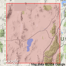
Type section (=principal reference section of Notch Peak Formation): [Sneakover Pass area], in sec. 5 [unsurveyed], T. 20 S., R. 13 W., Notch Peak 15-min quadrangle, central House Range, Millard Co., central western UT.
Reference section: Lawson Cove section, in E/2 sec. 4, T. 25 S., R. 15 W., Wah Wah Summit 15-min quadrangle, Gray Hills area, Wah Wah Mountains, Millard Co., central western UT.
Named from Red Tops, in sec. 31, T. 22 S., R. 13 W., The Barn 15-min quadrangle (1960 ed.), central House Range, Millard Co., central western UT.
Source: Publication.
- Usage in publication:
-
- Red Tops Member*
- AAPG geologic province:
-
- Great Basin province
- South Western Overthrust
Miller, J.F., Evans, K.R., Loch, J.D., Ethington, R.L., and Stitt, J.H., 2001, New lithostratigraphic units in the Notch Peak and House Formations (Cambrian-Ordovician), Ibex area, western Millard County, Utah: Brigham Young University Geology Studies, v. 46, p. 35-69.
Summary:
Red Tops Member of Notch Peak Formation. Age is considered Late Cambrian (late Millardan, Sunwaptan), following Cambrian classification of Palmer, 1998 (Canadian Jour. Earth Sci., v. 35, p. 323-328); condont zones PROCONODONTUS MUELLERI and EOCONODONTUS (EOCONODONTUS NOTCHPEAKENSIS to basal CAMBROOISTODUS MINUTUS subzone), trilobite zone SAUKIA (SAUKIELLA JUNIA tentatively to basal SAUKIELLA SEROTINA subzone).
Source: Publication.
For more information, please contact Nancy Stamm, Geologic Names Committee Secretary.
Asterisk (*) indicates published by U.S. Geological Survey authors.
"No current usage" (†) implies that a name has been abandoned or has fallen into disuse. Former usage and, if known, replacement name given in parentheses ( ).
Slash (/) indicates name conflicts with nomenclatural guidelines (CSN, 1933; ACSN, 1961, 1970; NACSN, 1983, 2005, 2021). May be explained within brackets ([ ]).