

- Usage in publication:
-
- Red Tanks member*
- Modifications:
-
- Named
- Dominant lithology:
-
- Limestone
- Sandstone
- Shale
- Siltstone
- AAPG geologic province:
-
- San Juan basin
- Orogrande basin
Summary:
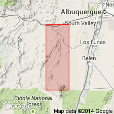
Named as upper of three members of Madera limestone of Magdalena group in Lucero uplift area, Valencia and Socorro Cos, NM in San Juan and Orogrande basins. No type locality designated. Forms a continuous belt along eastern side of Los Vallos from Breach Canyon on north to west foot of Monte de Belen on south. North of Breach Canyon it is covered for a short distance by basalt cap of South Mesa Lucero but comes to surface again in a wide fork extending south from Carrizo Arroyo where the most complete section of member is exposed. West of Ladron Mountains member is covered by pediment gravels, but crops out in several places in tributaries of Red Tanks Arroyo (from which it was named). Crops out in Comanche Arroyo. Lower part of member consists of dark-red-brown siltstone, sandstone, and shale. Locally base contains buff sandstone and limestone conglomerate. Upper part mostly gray, thin-bedded, nodular limestone and gray shale. Generally 200-300 ft thick. Limestone is marine; abundant fauna. Most prominent limestone generally at top. Along east Los Valles this limestone forms a line of low, disconnected hills in middle of valley. Some intertonguing of marine sediments of member with continental beds of overlying Permian? Abo formation. Contact with Abo is at top of uppermost marine limestone in member. Overlies Atrasado member (new) of Madera. Measured sections, cross sections, geologic map. Pennsylvanian age.
Source: GNU records (USGS DDS-6; Denver GNULEX).
For more information, please contact Nancy Stamm, Geologic Names Committee Secretary.
Asterisk (*) indicates published by U.S. Geological Survey authors.
"No current usage" (†) implies that a name has been abandoned or has fallen into disuse. Former usage and, if known, replacement name given in parentheses ( ).
Slash (/) indicates name conflicts with nomenclatural guidelines (CSN, 1933; ACSN, 1961, 1970; NACSN, 1983, 2005, 2021). May be explained within brackets ([ ]).