- Usage in publication:
-
- Red Pine shale
- Modifications:
-
- Named
- Dominant lithology:
-
- Shale
- AAPG geologic province:
-
- Southern Rocky Mountain region
Summary:
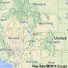
Named as the upper formation of Uinta Mountain group presumably for exposures along Red Pine Canyon, a tributary to Smith and Morehouse Creek, Summit Co, UT in the Southern Rocky Mountain region. No type locality designated specifically [but author refers to a type section that probably was meant to be in Red Pine Canyon]. Overlies newly named Box Canyon member of Mutual quartzite of Uinta Mountain group conformably. Unconformably underlies Cambrian Tintic quartzite. Name "Ophir" was applied to these rocks in earlier reports. Consists of slope-forming, mottled brown, greenish-brown, and gray, thinly bedded, micaceous shale that is uniform throughout western Uinta Mountains. Is 1,775 ft thick at mouth of Red Pine Canyon. Two miles to west the formation is 1,200 ft thick. Formation decreases in thickness westward. Is absent at South Fork basin. Pre-Tintic erosion cut deeply into Red Pine. Geologic map. Columnar section. Assigned to the pre-Cambrian.
Source: GNU records (USGS DDS-6; Denver GNULEX).

- Usage in publication:
-
- Red Pine Shale*
- Modifications:
-
- Geochronologic dating
- AAPG geologic province:
-
- Southern Rocky Mountain region
Summary:
Rb/Sr whole rock age of 925 +/-5 m.y. obtained from Red Pine Shale cutting from the Shell Oil Dahlgreen Creek Government Well No. 1 (SE1/4 NE1/4 NW1/4 sec 9, T2N, R14E) Summit Co, UT in the Southern Rocky Mountain region. Red Pine is the upper formation of Uinta Mountain Group. The K-Ar dates of 1,520 to 1,550 m.y. on Red Creek Quartzite beneath the Uinta Mountain Group provide limits of 1,400 to 950 for the group. These limits suggest equivalency to Belt Supergroup of MT and Big Cottonwood Formation of UT. Age changed from Precambrian to Precambrian Y.
Source: GNU records (USGS DDS-6; Denver GNULEX).

- Usage in publication:
-
- Red Pine Shale*
- Modifications:
-
- Age modified
- AAPG geologic province:
-
- Southern Rocky Mountain region
Summary:
Is the upper formation of the Uinta Mountain Group in northern UT in the Southern Rocky Mountain region. Has CHUARIA-bearing acritarchs and vase-shaped chitinozoan-like microfossils. These same fossils also occur in the Kwagunt Formation of the Chuar Group. Strata bearing these fossils predate the Windermere Supergroup and are considered to be early Late Proterozoic. Age modified from Middle Proterozoic to Late Proterozoic. Correlation chart.
Source: GNU records (USGS DDS-6; Denver GNULEX).
For more information, please contact Nancy Stamm, Geologic Names Committee Secretary.
Asterisk (*) indicates published by U.S. Geological Survey authors.
"No current usage" (†) implies that a name has been abandoned or has fallen into disuse. Former usage and, if known, replacement name given in parentheses ( ).
Slash (/) indicates name conflicts with nomenclatural guidelines (CSN, 1933; ACSN, 1961, 1970; NACSN, 1983, 2005, 2021). May be explained within brackets ([ ]).

