

- Usage in publication:
-
- Red Peak member
- Modifications:
-
- Named
- Dominant lithology:
-
- Shale
- Sandstone
- AAPG geologic province:
-
- Wind River basin
Summary:
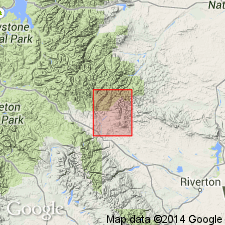
Named as lower member of Chugwater formation for Red Peak, a few miles east of Red Creek, southern Washakie Range, Fremont Co, WY, Wind River basin. No type locality designated. A section measured on east side of Red Creek in sec 36, T7N, R4W, sec 1, T6N, R4W, and sec 6, T6N, R3W, Fremont Co, has 566 ft of red shale and red sandstone. Underlies Crow Mountain member (new) of Chugwater at measured section. Is younger than Dinwoody formation. Of Triassic age. No fossils found. Geologic map.
Source: GNU records (USGS DDS-6; Denver GNULEX).
- Usage in publication:
-
- Red Peak Formation
- Modifications:
-
- Revised
- Overview
- AAPG geologic province:
-
- Wind River basin
- Bighorn basin
- Green River basin
Summary:
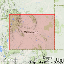
Raised to formation rank and assigned to Chugwater Group (rank raised) as lowermost of three formations in Wind River, Bighorn and Greater Green River basins, WY. Subdivided into four informal facies. Best exposed at Red Grade in area of secs 11, 14, 15 T5N, R6W, Fremont Co where Red Peak is 1000 ft thick. Also well exposed south of Thermopolis, Hot Springs Co and north of Rawlins, Carbon Co. Stratigraphic chart. Conformably overlies Dinwoody Formation; conformably underlies Crow Mountain Formation (rank raised) of Chugwater. Early Triassic age.
Source: GNU records (USGS DDS-6; Denver GNULEX).
- Usage in publication:
-
- Red Peak Formation*
- Modifications:
-
- Revised
- AAPG geologic province:
-
- Wind River basin
- Green River basin
Summary:
Raised to formation rank and assigned to Chugwater Group as its basal formation. Recognized in Wind River and Greater Green River basins. Underlies Crow Mountain Sandstone or Alcova Limestone. Lower contact not discussed. Assigned a Triassic age.
Source: GNU records (USGS DDS-6; Denver GNULEX).
- Usage in publication:
-
- Red Peak Formation*
- Modifications:
-
- Areal extent
- AAPG geologic province:
-
- Green River basin
Summary:
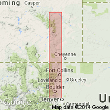
Extended into Routt Co, CO, Greater Green River basin. As few outcrops occur in quad and because of similar lithology with Goose Egg Formation, Red Peak and Goose Egg are not differentiated on geologic map (also mapped undifferentiated with Red Peak and Goose Egg are Bell Springs Member of Nugget Sandstone and Popo Agie and Jelm Formations). South of quad, Red Peak and Goose Egg are 285 ft thick. Early Triassic age.
Source: GNU records (USGS DDS-6; Denver GNULEX).
- Usage in publication:
-
- Red Peak Formation*
- Modifications:
-
- Areal extent
- AAPG geologic province:
-
- Denver basin
- Powder River basin
Summary:
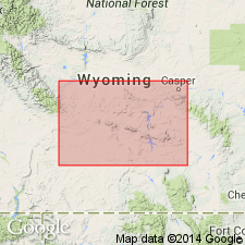
Used as Triassic Red Peak Formation of Chugwater Group from Mesa Mountain, Laramie Co, WY in the Denver basin north to Douglas, Converse Co, WY in Powder River basin. Underlies Canyon Springs Member of Sundance Formation unconformably.
Source: GNU records (USGS DDS-6; Denver GNULEX).
- Usage in publication:
-
- Red Peak Member*
- Modifications:
-
- Revised
- Areal extent
- AAPG geologic province:
-
- Green River basin
- North Park basin
Summary:
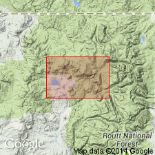
Reduced in rank and assigned as member of Chugwater Formation. Map is one of three (others are I-1113 and I-1114) which include northern Park Range, northernmost Gore Range and southernmost Sierra Madre within Grand, Jackson and Routt Cos, CO, Greater Green River and North Park basins. Mapping extends unit into North Park basin. Mapped undivided with other Triassic and Permian units. Thickness of undivided units range from 30-305 m. Assigned Triassic age.
Source: GNU records (USGS DDS-6; Denver GNULEX).
For more information, please contact Nancy Stamm, Geologic Names Committee Secretary.
Asterisk (*) indicates published by U.S. Geological Survey authors.
"No current usage" (†) implies that a name has been abandoned or has fallen into disuse. Former usage and, if known, replacement name given in parentheses ( ).
Slash (/) indicates name conflicts with nomenclatural guidelines (CSN, 1933; ACSN, 1961, 1970; NACSN, 1983, 2005, 2021). May be explained within brackets ([ ]).