The National Geologic Map Database is migrating to a new infrastructure. We apologize for any service disruptions during this process.
|
|---|


- Usage in publication:
-
- Red Lion formation*
- Modifications:
-
- Original reference
- Dominant lithology:
-
- Limestone
- Shale
- AAPG geologic province:
-
- Montana folded belt
Summary:
[Calkins and Emmons, 1913, USGS Prof. Paper 78.] Red Lion formation. Upper 250 feet consists of limestone with closely spaced siliceous laminae. Fossils are said by Walcott to be Upper Cambrian. Probably = Yogo limestone. Lower 25 feet is calcareous shale, mostly coal black, locally interbedded with thin layers of magnesium limestone. The lower member probably = Dry Creek shale [which is now (ca. 1936) considered Upper Cambrian]. Named for a mine at head of North Fork of Flint Creek, [Philipsburg region, Granite County, central western Montana]. The spur north of this mine is a hogback of the formation and affords good exposure of middle part. Age is Late Cambrian.
Source: US geologic names lexicon (USGS Bull. 896, p. 1785).
- Usage in publication:
-
- Red Lion formation
- Modifications:
-
- Areal extent
- AAPG geologic province:
-
- Montana folded belt
Summary:
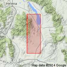
Rocks tentatively assigned to Dry Creek shale by Deiss (1936) are here reassigned to Red Lion formation at Mount Helena section (Grizzly and Oro Fino Gulches section of Deiss, 1936), Lewis and Clark County, Montana, Montana folded belt province. At Mount Helena, unit is 250 feet thick. Overlies Hasmark formation; unconformably underlies Maywood formation. Silicified brachiopods tentatively identified as BILLINGSELLA identified from middle marble bed of Red Lion on Squaw Gulch [now Wakina Sky Gulch]. Red Lion lithologically and faunally very like Snowy Range formation of southern Montana. Age is Late Cambrian.
[NOTE: Geographic feature Squaw Gulch renamed Wakina Sky Gulch (U.S. Board on Geographic Names, January 2000, USGS GNIS FeatureID 801527).]
Source: Modified from GNU records (USGS DDS-6; Denver GNULEX).
- Usage in publication:
-
- Red Lion formation
- Modifications:
-
- Areal extent
- Overview
- AAPG geologic province:
-
- Montana folded belt
Summary:
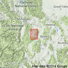
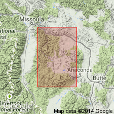
Extends name from Philipsburg quad, north of study area, into extreme southwest MT south of Boulder batholith and west of Yellowstone National Park within parts of Beaverhead, Madison and Gallatin Cos, MT, Montana folded belt province. Used in place of Dry Creek shale. Equivalent to Snowy Range formation and use of Snowy Range would be appropriate in study area, especially in eastern part. However, authors prefer using terminology used in Philipsburg area. Conformably overlies Hasmark formation; unconformably underlies Ordovician or Devonian rocks. Pre-Middle Ordovician and pre-Middle Devonian erosion have removed unit from most of southwest MT; forms persistent exposures only along northwest, northern and eastern margins of area. Thickness at measured Camp Creek section, Silver Bow Co, MT is 57 ft. Correlates in part with several units including St. Charles limestone in southeast ID, Pilgrim formation in central MT, Devils Glen dolomite in northern WY, and Deadwood formation in Black Hills, SD. Isopach map of Cambrian. Correlation chart. Cross section. Late Cambrian age.
Source: GNU records (USGS DDS-6; Denver GNULEX).

- Usage in publication:
-
- Red Lion formation
- Modifications:
-
- Overview
- Areal extent
- Revised
- AAPG geologic province:
-
- Montana folded belt
Summary:
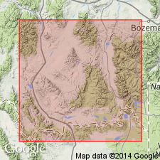
Extends throughout southwest MT from Mineral and Beaverhead Cos on west to at least as far east as Madison Range, Madison Co, MT, Montana folded belt province. Uses Red Lion in place of Lochman's (1950) Snowy Range formation in Three Forks area. Consists of a lower Dry Creek shale member and an upper Sage limestone member; these members are applicable as far west as Philipsburg. Locally Dry Creek is missing. Outside Philipsburg area unit generally thin and poorly exposed. Correlates with part of upper part of Gallatin formation in northwest WY and Worm Creek quartzite and lower part of St. Charles formation in northeast UT. Overlies Pilgrim formation; unconformably underlies Maywood formation. Many measured sections. Cross section. Correlation chart. Isopach map of combined Red Lion, Snowy Range, and Grove Creek formations. Fossil list. Late Cambrian (Franconian) age.
Source: GNU records (USGS DDS-6; Denver GNULEX).
- Usage in publication:
-
- Red Lion formation*
- Modifications:
-
- Overview
- AAPG geologic province:
-
- Montana folded belt
Summary:
Mapped as Red Lion and Maywood formations, undivided, those rocks occurring between Pilgrim and Jefferson dolomites. Exposed along flanks of anticline in Devils Fence quad, Jefferson and Broadwater Cos, MT, Montana folded belt province; also outcrops in vicinity of Elkhorn, Jefferson Co. Erosional unconformity separates Red Lion and Maywood. In part of Limestone Hills, a few miles east of study area, Red Lion is removed entirely and Maywood rests directly on Pilgrim. In southwest MT, varicolored argillaceous and impure carbonate rocks between Pilgrim and Jefferson have been given different names by different authors, though most commonly referred to as Dry Creek shale. In Philipsburg quad, this interval was divided into Red Lion and Maywood by Emmons and Calkins (1913); near Three Forks Peale (1893) called similar rocks Dry Creek shales and pebbly limestone of Gallatin formation; in Little Belt Mountains Weed (1900) used terms Dry Creek shale and Yogo limestone; and in Beartooth Range north of Yellowstone Park Dorf and Lochman (1940) proposed Snowy Range and Grove Creek formations. Thickness of Red Lion is 30-95 ft. Geologic maps; measured section; generalized stratigraphic section. Upper Cambrian brachiopod BILLINGSELLA found in Red Lion.
Source: GNU records (USGS DDS-6; Denver GNULEX).
- Usage in publication:
-
- Red Lion formation*
- Modifications:
-
- Areal extent
- AAPG geologic province:
-
- Montana folded belt
Summary:
Pg. 495-496, pl. 42. Red Lion formation. In area of report [Townsend Valley, Broadwater and Jefferson Counties, central Montana], Red Lion formation of Cambrian age and Maywood formation of Late Devonian age are mapped as a unit although the two formations are separated by erosional unconformity. This undivided unit = Peale's (1893) Dry Creek shale.
Source: US geologic names lexicon (USGS Bull. 1200, Maywood entry p. 2435); supplemental information from GNU records (USGS DDS-6; Denver GNULEX).
- Usage in publication:
-
- Red Lion Formation
- Modifications:
-
- Age modified
- Areal extent
- AAPG geologic province:
-
- Montana folded belt
Summary:
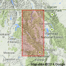
Divides unit into a lower part consisting of Dry Creek Shale Member and an upper part of laminated limestone in northern Granite Co and adjoining portions of Powell and Missoula Cos, MT in Montana folded belt province. Lower part is about 30 ft thick; upper part is 330 ft thick. Unconformably overlies Hasmark Formation. Unconformably underlies Maywood Formation. Assigns Late Cambrian (Croixan; Franconian to early Trempealeauan) age. Geologic map. Measured section. Stratigraphic column.
Source: GNU records (USGS DDS-6; Denver GNULEX).
- Usage in publication:
-
- Red Lion Formation*
- Modifications:
-
- Areal extent
- AAPG geologic province:
-
- Montana folded belt
Summary:
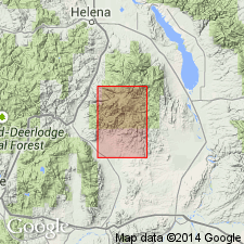
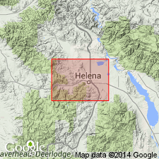
Maps unit in northern Boulder batholith area in Lewis and Clark and Jefferson Cos, MT in Montana folded belt province. Outcrop trends northwest-southeast from northwestern to central part of mapped area, then trends easterly to southwestern edge of map. Unit is about 160 ft thick. Overlies Upper Cambrian Hasmark Dolomite; underlies Upper Devonian Jefferson Formation. Upper 30 ft may include Upper? Devonian Maywood Formation. Unit assigned Late Cambrian age based on BILLINGSELLA found at Squaw Gulch [now Wakina Sky Gulch] in limestone slab in "marker" zone, which occurs in upper 100 ft of unit.
[NOTE: Geographic feature Squaw Gulch renamed Wakina Sky Gulch (U.S. Board on Geographic Names, January 2000, USGS GNIS FeatureID 801527).]
Source: GNU records (USGS DDS-6; Denver GNULEX).
- Usage in publication:
-
- Red Lion Formation
- Modifications:
-
- Overview
- AAPG geologic province:
-
- Montana folded belt
Summary:
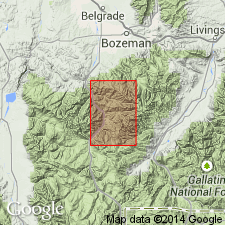
Used in preference to Snowy Range Formation because of predominance of ribbony carbonate beds. Divided into Dry Creek Shale member [Member] in lower part and an upper unnamed member. Thickness of Red Lion ranges from 130 ft on Garnet Mountain, 180 ft at Moose Creek and 235 ft near Mount Blackmore; absent in southwest and locally in northwest parts of map area. Quad is in Montana folded belt province. Dry Creek ranges from 0-35 ft thick. Lower part of upper unnamed member contains many trilobites and brachiopods. Overlies Pilgrim Limestone; unconformably underlies Maywood Formation. Mapped undivided with Pilgrim. Late Cambrian age.
Source: GNU records (USGS DDS-6; Denver GNULEX).
- Usage in publication:
-
- Red Lion Formation*
- Modifications:
-
- Areal extent
- AAPG geologic province:
-
- Montana folded belt
Summary:
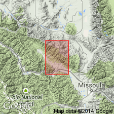
Maps Red Lion separately as lower part and upper part in northwest MT in Montana folded belt province. Outcrops in southern part of quad in areas of Ninemile Creek and Clark Fork, Missoula and Mineral Cos. Lower part consists of a lower shale unit 75 ft thick and an upper limestone unit about 350 ft thick. Upper part is dolomite and is 80 ft thick at an incomplete section about 1 mi southwest of mouth of Sixmile Creek. Conformably overlies Middle and Upper Cambrian Hasmark Dolomite. Overlain by Tertiary and Quaternary rocks and sediments. Trilobite CHARIOCEPHALUS, characteristic of medial Late Cambrian, present about 50 ft below top of lower part of Red Lion. Brachiopod, possibly EOORTHIS, present about 100 ft below top of lower part. Geologic map.
Source: GNU records (USGS DDS-6; Denver GNULEX).
- Usage in publication:
-
- Red Lion Formation*
- Modifications:
-
- Age modified
- Areal extent
- AAPG geologic province:
-
- Montana folded belt
Summary:
Extends unit into northern part of Ruby Range, Madison Co, MT in Montana folded belt province. Thickness ranges from about 115 to 170 ft. Formation is not present in Trout Creek drainage area. Conformably overlies Upper Cambrian Pilgrim Dolomite. Unconformably underlies Upper Devonian Jefferson Formation. In ascending order divides into Dry Creek Shale Member and Sage Dolomite Member. Correlates with Snowy Range Formation in Bozeman area. Fossils collected about 60 ft above base of Red Lion in measured section H (in open-file report by Tysdal, 1970) include brachiopod BILLINGSELLA and trilobite TAENICEPHALUS indicating Late Cambrian (Franconian) age. Stratigraphic column. Correlation chart.
Source: GNU records (USGS DDS-6; Denver GNULEX).
- Usage in publication:
-
- Red Lion Formation
- Modifications:
-
- Areal extent
- AAPG geologic province:
-
- Montana folded belt
Summary:
Authors propose extending Middle and Upper Cambrian units of Wells (1974) in Alberton area, Mineral Co, MT northwest to Libby area, Lincoln Co, MT, a distance of 76 mi. Within study area, located in Montana folded belt province, Red Lion overlies Hasmark Dolomite. Unit overlying Red Lion not discussed. Total thickness of Cambrian units is 3248 ft in Libby area and 2380 ft in Alberton area; difference in thickness due to erosion at top of Red Lion in Alberton area. Red Lion correlates with Aadland's (1979, unpublished thesis) facies four and five of Fishtrap Dolomite. Red Lion consists of terrigenous sediments derived from a local highland and deposited across a well-developed tidal flat. Late Cambrian trilobites found in lower part of unit.
Source: GNU records (USGS DDS-6; Denver GNULEX).
For more information, please contact Nancy Stamm, Geologic Names Committee Secretary.
Asterisk (*) indicates published by U.S. Geological Survey authors.
"No current usage" (†) implies that a name has been abandoned or has fallen into disuse. Former usage and, if known, replacement name given in parentheses ( ).
Slash (/) indicates name conflicts with nomenclatural guidelines (CSN, 1933; ACSN, 1961, 1970; NACSN, 1983, 2005, 2021). May be explained within brackets ([ ]).