

- Usage in publication:
-
- Red Bluff group
- Modifications:
-
- Named
- Dominant lithology:
-
- Clay
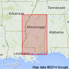
- AAPG geologic province:
-
- Mid-Gulf Coast basin
Summary:
Red Bluff group described as irregular masses of fine-grained ferruginous rock, embedded in a brownish or greenish clayey mass, both with well-preserved fossils. Thickness 12 ft. Seems to stand intermediate, by position as well as fossils, between Vicksburg group and Jackson group, but fauna seems on whole to approach more nearly the Vicksburg than the Jackson.
Source: GNU records (USGS DDS-6; Reston GNULEX).
- Usage in publication:
-
- Red Bluff clay*
- Modifications:
-
- Revised
- AAPG geologic province:
-
- Mid-Gulf Coast basin
Summary:
Forest Hill sand interpreted as deltaic equivalent of Red Bluff. This agree with Cooke's (1918) original assessment. Vicksburg group is restricted below to exclude Forest Hill sand and Red Bluff clay. Chart shows Red Bluff clay overlies Yazoo clay and underlies Marianna limestone. Note on derivation of name.
Source: GNU records (USGS DDS-6; Reston GNULEX).
- Usage in publication:
-
- Red Bluff member
- Modifications:
-
- Revised
- AAPG geologic province:
-
- Mid-Gulf Coast basin
Summary:
Rank of Red Bluff reduced to member status in Forest Hill formation. As restricted, consists of 10 to 14 ft of highly to slightly glauconitic fossiliferous dark-gray clay with one or more zones of argillaceous glauconitic limestone concretions.
Source: GNU records (USGS DDS-6; Reston GNULEX).
- Usage in publication:
-
- Red Bluff Clay*
- Modifications:
-
- Revised
- AAPG geologic province:
-
- Mid-Gulf Coast basin
Summary:
Red Bluff reassigned to Vicksburg Group as used by Deboo (1965: AL Geol. Survey Bull. 80). Overlies Jackson Group (Yazoo Clay or Ocala Limestone); underlies Forest Hill Sand or Marianna Limestone, both of Vicksburg Group.
Source: GNU records (USGS DDS-6; Reston GNULEX).
- Usage in publication:
-
- Red Bluff Formation*
- Modifications:
-
- Revised
- AAPG geologic province:
-
- Mid-Gulf Coast basin
Summary:
Red Bluff removed from Vicksburg Group (now underlying Vicksburg and its Mint Spring and Marianna Formations) but remains of Vicksburgian Age. Name changed from Red Bluff Clay to Red Bluff Formation.
Source: GNU records (USGS DDS-6; Reston GNULEX).
- Usage in publication:
-
- Red Bluff Clay*
- Modifications:
-
- Revised
- AAPG geologic province:
-
- Mid-Gulf Coast basin
Summary:
On correlation chart, Red Bluff Clay used in AL, rather than Red Bluff Formation. Author considers lithologic term more appropriate (oral comm., 1984).
Source: GNU records (USGS DDS-6; Reston GNULEX).
- Usage in publication:
-
- Red Bluff Clay
- Modifications:
-
- Overview
- AAPG geologic province:
-
- Mid-Gulf Coast basin
Summary:
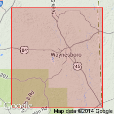
The Bumpnose Limestone, Red Bluff Clay, and Forest Hill Sand of the Vicksburg Group are facies equivalents that grade into one another laterally and vertically. At the reference locality in Wayne Co., MS, established by Brown and Huff (1963), unit ranges in thickness from 11 to 32 ft and consists mainly of dark-gray to light-brown, fossiliferous, glauconitic, ferruginous marls and clays. Red Bluff thins to the west as it grades into the basal fluvial and deltaic sediments of the Forest Hill Sand. Unit is absent in central and western MS and the Forest Hill in that area disconformably overlies the Yazoo Clay of the Jackson Group.
Source: GNU records (USGS DDS-6; Reston GNULEX).
For more information, please contact Nancy Stamm, Geologic Names Committee Secretary.
Asterisk (*) indicates published by U.S. Geological Survey authors.
"No current usage" (†) implies that a name has been abandoned or has fallen into disuse. Former usage and, if known, replacement name given in parentheses ( ).
Slash (/) indicates name conflicts with nomenclatural guidelines (CSN, 1933; ACSN, 1961, 1970; NACSN, 1983, 2005, 2021). May be explained within brackets ([ ]).