The National Geologic Map Database is migrating to a new infrastructure. We apologize for any service disruptions during this process.
|
|---|


- Usage in publication:
-
- Red Bluff sandstones
- Modifications:
-
- Original reference
- Dominant lithology:
-
- Sandstone
- Shale
- AAPG geologic province:
-
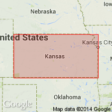
- Anadarko basin
Summary:
Pg. 3, 40. Red Bluff sandstones. Light-red friable and porous sandstones and shales, 175 to 200 feet thick, composing next to lowest formation and major part of Kiger division. Overlies Dog Creek shales and underlies Day Creek dolomite. [Later reports give maximum thickness 500+ feet.] Age is Permian.
[Named from exposures at former post office of Red Bluff, Comanche Co., central southern KS.]
Source: US geologic names lexicon (USGS Bull. 896, p. 1783).

- Usage in publication:
-
- Red Bluff sandstone
- Modifications:
-
- Abandoned
Summary:
†Red Bluff sandstone of Cimarron group abandoned. Preoccupied. Replaced with Whitehorse sandstone.
Source: US geologic names lexicon (USGS Bull. 896, p. 1783).
For more information, please contact Nancy Stamm, Geologic Names Committee Secretary.
Asterisk (*) indicates published by U.S. Geological Survey authors.
"No current usage" (†) implies that a name has been abandoned or has fallen into disuse. Former usage and, if known, replacement name given in parentheses ( ).
Slash (/) indicates name conflicts with nomenclatural guidelines (CSN, 1933; ACSN, 1961, 1970; NACSN, 1983, 2005, 2021). May be explained within brackets ([ ]).