

- Usage in publication:
-
- Rebel Limestone
- Modifications:
-
- Named
- Dominant lithology:
-
- Limestone
- AAPG geologic province:
-
- Great Basin province
Summary:
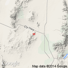
Occurs in Rebel mine area, secs.4,5,8,9 T28S R11W, Beaver Co, UT. Name credited to Townsend (1953, U.S. Bureau of Mines Report of Investigations 4953) in Harrington-Hickory mine area adjacent to Rebel area on the south. Consists predominantly of recrystallized and generally bleached limestone and dolomitic limestone with few beds of tan, massive sandstone, and argillic and arkosic siltstone. Is probably about 1200 ft thick. Conformably underlies "unnamed" quartzite which in turn underlies Williams Limestone. Is part of folded and faulted sedimentary sequence of late Paleozoic age.
Source: GNU records (USGS DDS-6; Menlo GNULEX).
For more information, please contact Nancy Stamm, Geologic Names Committee Secretary.
Asterisk (*) indicates published by U.S. Geological Survey authors.
"No current usage" (†) implies that a name has been abandoned or has fallen into disuse. Former usage and, if known, replacement name given in parentheses ( ).
Slash (/) indicates name conflicts with nomenclatural guidelines (CSN, 1933; ACSN, 1961, 1970; NACSN, 1983, 2005, 2021). May be explained within brackets ([ ]).