

- Usage in publication:
-
- Reany Creek Formation*
- Modifications:
-
- Named
- Dominant lithology:
-
- Conglomerate
- Graywacke
- Quartzite
- Slate
- AAPG geologic province:
-
- Wisconsin arch
Summary:
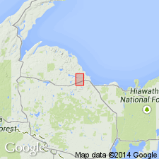
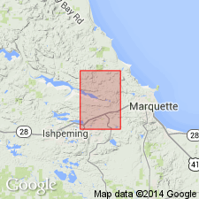
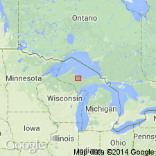
Named for metamorphosed sedimentary rocks in parts of Marquette Co, northwest MI in the Lake Superior region. Named for stream that flows across exposures in eastern part of T48N, R26W. Type section designated for line of exposures which extends north from Dead River Storage Basin for about 1,750 ft. Top boundary not well defined since upper part is in fault contact with sheared rocks of Mona Schist. Unit includes Holyoke Formation of Wadsworth (1893). Is divided into a 1) basal conglomerate; 2) middle sequence of graywacke and slate containing disrupted beds of arkose and dispersed clasts of granitic rock; and 3) upper limit of arkose, quartzite, slaty graywacke, and conglomerate. Maximum thickness is about 3,000-3,500 ft. Age presumed to be middle Precambrian because is intruded by Keweenawan dikes and rests unconformably on lower Precambrian rocks. Geologic maps, detailed petrologic and lithologic descriptions, and chemical analyses. Is of possible glacial origin.
Source: GNU records (USGS DDS-6; Reston GNULEX).
- Usage in publication:
-
- Reany Creek Formation*
- Modifications:
-
- Revised
- Overview
- AAPG geologic province:
-
- Wisconsin arch
Summary:
Is lowermost middle Precambrian formation mapped in east-west trending belt across north-central part of Negaunee quadrangle, Marquette Co, MI (Lake Superior region). Is included as basal unit of Chocolay Group (revised) at base of Marquette Range Supergroup (revised). Unconformably overlies Lighthouse Point Member of Mona Schist (lower Precambrian); true top is not known, upper part is faulted down against Mona Schist. Consists of: 1) basal conglomerate; 2) middle unit of chloritic slate with widely scattered granitic boulders and intraclasts of arkose; and 3) upper unit of interbedded conglomerate, slaty graywacke, and lenses of quartzite and arkose. Apparently terminates against faults inferred along east margin of map in sec 12, T48N, R26W. Is interpreted as glacial deposit: "The isolated boulders in the slate are believed to have been ice rafted. Torrential melt-water streams deposited the layers of conglomerate in the upper unit. The arkose was deposited by subglacial streams. The coarse conglomerate at the base was deposited in U-shaped valleys scoured by alpine-type glaciers." Reany Creek is similar to Enchantment Lake Formation in Marquette syncline; no meaningful age data on which to base correlation.
Source: GNU records (USGS DDS-6; Reston GNULEX).
- Usage in publication:
-
- Reany Creek Formation*
- Modifications:
-
- Age modified
- Revised
- Overview
- AAPG geologic province:
-
- Wisconsin arch
Summary:
Is the youngest Archean unit in the several-thousand-meter-thick Archean greenstone-granite terrane in the Marquette area, MI (Lake Superior region). Is a heterogeneous body of conglomerate, arkose, chloritic slate, graywacke, and boulder-bearing slate mapped north of Great Lakes tectonic zone. Is considered younger than Archean granitoid rocks of the greenstone-granite terrane. Is no longer considered to be part of the Early Proterozoic Chocolay Group of Marquette Range Supergroup; is herein considered older than Chocolay. Transects structures in the older volcanic rocks, is less deformed than the volcanic rocks, and is bounded along its southern margin by the northwest-trending Dead River shear zone (Archean). Historically, its age has been uncertain, but its penetrative foliation, asymmetry of basin fill, and relationship to the Dead River shear zone strongly suggest that it developed concurrently with dextral shear along the Dead River shear zone. Is similar to "Temiskaming-type" sequences, such as the Seine Group, in northern Ontario, interpreted as forming in Archean analogues to modern pull-apart basins. Is considered to be late-tectonic conglomerate. Age is considered to be Late Archean.
Source: GNU records (USGS DDS-6; Reston GNULEX).
For more information, please contact Nancy Stamm, Geologic Names Committee Secretary.
Asterisk (*) indicates published by U.S. Geological Survey authors.
"No current usage" (†) implies that a name has been abandoned or has fallen into disuse. Former usage and, if known, replacement name given in parentheses ( ).
Slash (/) indicates name conflicts with nomenclatural guidelines (CSN, 1933; ACSN, 1961, 1970; NACSN, 1983, 2005, 2021). May be explained within brackets ([ ]).