The National Geologic Map Database is migrating to a new infrastructure. We apologize for any service disruptions during this process.
|
|---|


- Usage in publication:
-
- Reagan sandstone*
- Modifications:
-
- Original reference
- Dominant lithology:
-
- Arkose
- Sandstone
- AAPG geologic province:
-
- Ouachita folded belt
- South Oklahoma folded belt
Summary:
Reagan sandstone [incorrectly spelled Regan on map legends]. In Atoka quadrangle is represented by a single outcrop. [See 1903 definition in type region.]
Source: US geologic names lexicon (USGS Bull. 896, p. 1780-1781).
- Usage in publication:
-
- Reagan sandstone*
- Modifications:
-
- Principal reference
- Dominant lithology:
-
- Arkose
- Sandstone
- AAPG geologic province:
-
- South Oklahoma folded belt
Summary:
Reagan sandstone. Lower part (in contact with the granite) where formation is thickest is poorly sorted coarse granitic material composed chiefly of grains of quartz with some feldspar. This basal arkose member is variable in occurrence as well as in thickness and in places is absent altogether, allowing the purer sandstone beds higher in section to rest in contact with the granite. The middle part is composed chiefly of quartz grains, varying in size from that of a pea to fine particles. The upper part is calcareous and shaly sandstone, successive beds of which become more limy upward until the purer limestone of Arbuckle formation is reached. Thickness a few feet to 500+/- feet.
Named from village [of Reagan, 10 mi north of Tishomingo, in Tishomingo quadrangle, Johnston Co., central southern OK], which is situated near the small area of the formation on north side of the granite.
Source: US geologic names lexicons (USGS Bull. 896, p. 1780-1781, USGS Bull. 1200, p. 3211-3212).

- Usage in publication:
-
- Reagan sandstone
- Modifications:
-
- Revised
- Age modified
- AAPG geologic province:
-
- South Oklahoma folded belt
Summary:
Pg. 624, 642, 661, 666, pl. 27. Introduced Honey Creek limestone member of Reagan sandstone for limestones which he stated were originally included in Arbuckle limestone but are now transferred to Reagan sandstone. Age is considered Late Cambrian.
Source: US geologic names lexicon (USGS Bull. 896, p. 1780-1781); supplemental information from GNU records (USGS DDS-6; Denver GNULEX).
- Usage in publication:
-
- Reagan sandstone*
- Modifications:
-
- Areal extent
Summary:
Followed Taff's original definitions of Arbuckle limestone and Reagan sandstone, and included Ulrich's Honey Creek limestone in Arbuckle limestone. This is definition of Reagan sandstone that is followed by the USGS.
[GNC remark (ca. 1938, US geologic names lexicon, USGS Bull. 896, Arbuckle entry p. 66): In 1932 Ulrich raised Honey Creek limestone to rank of a formation. (See 1932 entry under Reagan sandstone, also see under Honey Creek limestone.) The USGS now recognizes Honey Creek limestone as a distinct formation, which is a slight restriction of Arbuckle limestone.]
Source: US geologic names lexicon (USGS Bull. 896, p. 1780-1781, Arbuckle entry p. 66).
- Usage in publication:
-
- Reagan sandstone
- Modifications:
-
- Revised
- AAPG geologic province:
-
- South Oklahoma folded belt
Summary:
Pg. 742. Reagan sandstone as defined by Taff (Atoka and Tishomingo folios) included a considerable thickness of calcareous beds which were separated from Arbuckle limestone because they were thought to contain a Middle Cambrian fauna. This fauna was subsequently recognized as Upper Cambrian, and in the Revision (GSA Bull., v. 22, 1911) I proposed Honey Creek limestone member for these strata, still considering them a part of the Reagan. Later work in Llano-Burnet area in [central] Texas has resulted in a threefold division of the Cambrian into the Hickory, Cap Mountain, and Wilberns formations. The first corresponds essentially to the Reagan of Oklahoma and the main portion of the last to Honey Creek member, leaving Cap Mountain formation unrepresented in Oklahoma section except at a single locality on south side of Arbuckle Mountains in Pickens ranch section, 10 miles northwest of Tishomingo. Because of known absence of strata corresponding to the Cap Mountain in most sections examined in Arbuckle and Wichita Mountains, Oklahoma, it seems advisable to raise Honey Creek member to rank of formation which is essentially = Wilberns of [central] Texas, the Davis of Missouri, and the Franconia of Wisconsin.
[GNC remark (ca. 1938, US geologic names lexicon, USGS Bull. 896, p. 1781): The USGS now treats Honey Creek limestone as a distinct formation. This involves a slight redefinition of Arbuckle limestone, in which the Honey Creek has heretofore been included.]
Source: US geologic names lexicon (USGS Bull. 896, p. 1780-1781).
- Usage in publication:
-
- Reagan sandstone
- Modifications:
-
- Revised
- AAPG geologic province:
-
- South Oklahoma folded belt
Summary:
Pg. 55, 56. Reagan sandstone, basal formation in Timbered Hills group (new). Underlies Cap Mountain sandstone. Pebbly sandstone 500 feet thick; carries much glauconite and becomes calcareous at top. Separated from Precambrian by unconformity; Colbert porphyry and Tishomingo granite are oldest exposed rocks. [Age is Late Cambrian.]
Source: US geologic names lexicon (USGS Bull. 1200, p. 3211-3212).
- Usage in publication:
-
- Reagan sandstone
- Modifications:
-
- Areal extent
- AAPG geologic province:
-
- Chautauqua platform
Summary:
Sandstone locally overlying pre-Cambrian granite in Muskogee-Porum district, Muskogee and McIntosh Cos, OK on Chautauqua platform, is called by some "Reagan" sandstone. Age is Cambrian.
Source: GNU records (USGS DDS-6; Denver GNULEX).

- Usage in publication:
-
- Reagan sandstone
- Modifications:
-
- Areal extent
- AAPG geologic province:
-
- Central Kansas uplift
- Sedgwick basin
Summary:
In subsurface in central KS, Central Kansas uplift and Sedgwick basin, the sand underlying Arbuckle limestone variously called Basal sand, Reagan sand, or LaMotte sandstone. Thickness in one well 330 ft. Overlies igneous and metamorphic basement. Age is Cambrian.
Source: GNU records (USGS DDS-6; Denver GNULEX).
- Usage in publication:
-
- Reagan sandstone
- Modifications:
-
- Principal reference
- Dominant lithology:
-
- Conglomerate
- Arkose
- Sandstone
- Limestone
- AAPG geologic province:
-
- South Oklahoma folded belt
Summary:
Pg. 16 (table 1), 18. Reagan sandstone of Timbered Hills group. Commonly rests unconformably on igneous rocks, but in one exposure about 98 feet of dense limestones separate it from igneous rocks. In some places, contact with overlying Honey Creek is fairly sharp; more commonly there is gradation zone at top, especially on northeast flank of Wichita Mountains. Here an alternation of sandstones and limestones make it impossible to choose distinct plane of separation between the two formations. Note on type section [see J.A. Taff, 1904, Prof. Paper 31; Oklahoma Geol. Survey Bull., no. 12, p. 18, 1928]. Thickness 460 feet at type section; 200 to 460 feet in Arbuckle Mountains and 0 to 134 feet in the Wichita Mountains. Age is Late Cambrian, based on fossils identified from the interbedded limestones.
Type section: about 5 mi southwest of village of Mill Creek, Johnston Co., central southern OK.
Source: Publication; US geologic names lexicon (USGS Bull. 1200, p. 3211-3212).

- Usage in publication:
-
- Reagan sandstone*
- Modifications:
-
- Areal extent
- AAPG geologic province:
-
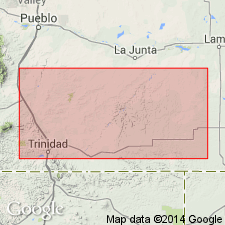
- Las Animas arch
Summary:
Recognized in one well, in Kiowa County, eastern Colorado, on Las Animas arch. Is 15 feet of dolomitic and glauconitic sandstone; variously called LaMotte sandstone, Reagan sandstone, and Sawatch sandstone. Is the basal unit overlying the Precambrian basement. Age is Cambrian. Report includes correlation chart.
Source: Modified from GNU records (USGS DDS-6; Denver GNULEX).
- Usage in publication:
-
- Reagan sandstone
- Modifications:
-
- Areal extent
Summary:
Pg. 1349-1355. Two units, namely, the so-called Cap Mountain formation and the "basal limestone" are, on basis of faunal evidence and stratigraphic position, herein considered to be equivalents of all or parts of Honey Creek formation.
Source: US geologic names lexicon (USGS Bull. 1200, p. 3211-3212).
- Usage in publication:
-
- Reagan sandstone
- Modifications:
-
- Areal extent
- AAPG geologic province:
-
- Anadarko basin
- Palo Duro basin
Summary:
In western Anadarko basin, TX Panhandle, Palo Duro basin, in subsurface, an unnamed basal quartz sand or arkose sand rests unconformably on pre-Cambrian igneous rocks. Sand correlates with Reagan sandstone in OK and Hickory sandstone in TX. Correlation chart. Age is Upper Cambrian.
Source: GNU records (USGS DDS-6; Denver GNULEX).
- Usage in publication:
-
- Reagan sandstone
- Modifications:
-
- Areal extent
- AAPG geologic province:
-
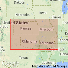
- Anadarko basin
- Arkoma basin
- Ouachita folded belt
- Palo Duro basin
- South Oklahoma folded belt
Summary:
In subsurface in most of OK [Palo Duro, Arkoma, and Anadarko basins, South Oklahoma folded belt and Ouachita tectonic folded belt provinces], Reagan sandstone is used for sandstone below "Arbuckle" lime. In southern OK probably is younger than Dresbachian Bonneterre dolomite and Lamotte sandstone of surface. Age is Cambrian.
Source: GNU records (USGS DDS-6; Denver GNULEX).

- Usage in publication:
-
- Reagan Sandstone*
- Modifications:
-
- Areal extent
- AAPG geologic province:
-
- Anadarko basin
- Central Kansas uplift
Summary:
In subsurface in KS, basal Paleozoic sand is termed LaMotte Sandstone (in eastern KS), and Reagan Sandstone (in western KS), Central Kansas uplift and Anadarko basin. Consists of fine to coarse quartz grains, white to gray. In places is dolomitic, and in places has traces of glauconite. Locally it is missing. Underlies Arbuckle; overlies Precambrian. Age is Late Cambrian.
Source: GNU records (USGS DDS-6; Denver GNULEX).
- Usage in publication:
-
- Reagan Sandstone
- Modifications:
-
- Areal extent
- AAPG geologic province:
-
- Arkoma basin
- Palo Duro basin
- South Oklahoma folded belt
Summary:
In Wichita Mountains and in the subsurface in Oklahoma folded belt province, the unit underlying Reagan Sandstone is named Carlton Rhyolite Group and is dated isotopically at 525 m.y., or Middle Cambrian?. Locally the Reagan overlies intrusive rocks dated as Middle Cambrian?. In Arbuckle Mountains and in the subsurface to the east, Reagan unconformably overlies Precambrian granites. Subsurface occurrence of Reagan extended to Palo Duro basin and Arkoma basin, OK. Age of Reagan is Late Cambrian.
Source: GNU records (USGS DDS-6; Denver GNULEX).
- Usage in publication:
-
- Reagan Sandstone
- Modifications:
-
- Areal extent
- AAPG geologic province:
-
- Central Kansas uplift
Summary:
Basal Paleozoic sand in two wells in Rooks and Norton Cos, KS on Central Kansas uplift is described--called Reagan, or Lamotte, or basal sandstone. Consists of quartzose sandstone, white to gray, pink, or red depending on amount of feldspar and nature of cement. It is fine- to coarse-grained. Feldspar more abundant at base. Dolomite increases upward to become 50 percent of upper few ft. Glauconite is abundant. Overlies Precambrian basement; underlies Arbuckle Group. Age is Cambrian.
Source: GNU records (USGS DDS-6; Denver GNULEX).
- Usage in publication:
-
- Reagan Sandstone
- Modifications:
-
- Areal extent
- AAPG geologic province:
-
- Central Kansas uplift
Summary:
In subsurface in central KS on Central Kansas uplift, an arkose unit which rests on Precambrian basement is called "granite wash", and is not directly associated with the overlying Reagan, although contact is transitional in places. Thickness of arkose ranges from 0-100 ft. Age is Late Cambrian.
Source: GNU records (USGS DDS-6; Denver GNULEX).
- Usage in publication:
-
- Reagan Sandstone
- Modifications:
-
- Areal extent
- AAPG geologic province:
-
- Central Kansas uplift
- Nemaha anticline
- Salina basin
Summary:
Designation of Rice Formation for a thick sequence of feldspathic sandstone and shale creates a formal unit for these rocks that, based on petrographic evidence, unconformably underlie the Upper Cambrian Reagan in central Kansas subsurface in Nemaha anticline, Salina basin, and central Kansas uplift provinces, KS.
Source: GNU records (USGS DDS-6; Denver GNULEX).
- Usage in publication:
-
- Reagan Sandstone
- Modifications:
-
- Areal extent
- AAPG geologic province:
-
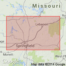
- Chautauqua platform
- Cherokee basin
- Ozark uplift
Summary:
Reagan Sandstone. Present in subsurface of southwest Missouri, and notably Cherokee and Crawford Counties, southeast Kansas (where rocks were formerly called Lamotte Sandstone; Lamotte is a clean quartz sandstone). Consists of fine- to coarse-grained, poorly sorted sandstone containing silt and shale; is generally arkosic at base, and glauconitic. Thickness is 30 to 125 feet. Overlies Precambrian rocks; underlies Davis Formation or [/]Derby-Doerun dolomite [both of Elvins Group]. Is a time-transgressive, nearshore facies of Davis mostly, and Bonneterre Formations. Age is Late Cambrian (Franconian). Report includes cross section.
[The use of a hyphen between undifferentiated formations is not considered proper notation (CSN, 1933).]
Source: Missouri lexicon (Thompson, 2001, Missouri Geol. Survey Rpt. Inv., no. 73, p. 162, 237); GNU records (USGS DDS-6; Denver GNULEX).
- Usage in publication:
-
- Reagan Sandstone*
- Modifications:
-
- Areal extent
- AAPG geologic province:
-
- Las Animas arch
Summary:
In eastern CO subsurface, Las Animas arch, basal Cambrian sandstone generally is called Reagan Sandstone, and less commonly, Lamotte Sandstone. Overlies Precambrian basement. Underlies Bonneterre and Eminence Dolomites. Beds are older in southeast corner of CO than in Colorado Springs area. Correlation chart. Age is Late Cambrian.
Source: GNU records (USGS DDS-6; Denver GNULEX).
- Usage in publication:
-
- Reagan Sandstone*
- Modifications:
-
- Areal extent
- AAPG geologic province:
-
- Las Vegas-Raton basin
Summary:
Overlies newly named Proterozoic Y Las Animas Formation in subsurface of Las Animas Co., CO in Las Vegas-Raton basin in Phillips Petroleum Co. No. 1 E. W. Haskins well, the reference well of the upper part of Las Animas Formation.
Source: GNU records (USGS DDS-6; Denver GNULEX).
- Usage in publication:
-
- Reagan Sandstone*
- Modifications:
-
- Not used
Summary:
Not used. Use of term has been confusing because similar Cambrian clastic lithofacies are present across all of southern MO. Reagan has not generally been differentiated from clastic deposits of Lamotte Sandstone. Lamotte is used in place of Reagan in Springfield quad, Ozark uplift, MO.
Source: GNU records (USGS DDS-6; Denver GNULEX).
For more information, please contact Nancy Stamm, Geologic Names Committee Secretary.
Asterisk (*) indicates published by U.S. Geological Survey authors.
"No current usage" (†) implies that a name has been abandoned or has fallen into disuse. Former usage and, if known, replacement name given in parentheses ( ).
Slash (/) indicates name conflicts with nomenclatural guidelines (CSN, 1933; ACSN, 1961, 1970; NACSN, 1983, 2005, 2021). May be explained within brackets ([ ]).