

- Usage in publication:
-
- Reading blue limestone
- Modifications:
-
- Original reference
- AAPG geologic province:
-
- Forest City basin
- Cherokee basin
Summary:
Pg. 150. Reading blue limestone. Fossiliferous limestone, 3 feet thick, formerly called Emporia blue limestone. Extends across Greenwood, Lyon, and Osage Counties, eastern Kansas, and probably much farther. Underlies Olpe shales (restriction of Adams' definition of Olpe) and overlies Humphrey shales. Age is Pennsyvlanian.
Source: US geologic names lexicon (USGS Bull. 896, p. 1779).

- Usage in publication:
-
- Reading limestone member
- Modifications:
-
- Revised
- AAPG geologic province:
-
- Forest City basin
- Nemaha anticline
Summary:
Pg. 10. Reading limestone member, bluish gray, 1 or 2 beds, weathers brownish, 3+/- feet thick. Basal member of Preston ("Emporia") limestone formation. Underlies Harveyville shale (member of Preston formation) and overlies Auburn shale formation. The Preston is overlain by Willard shale. All included in Wabaunsee group. Age is Late Pennsylvanian (Virgil).
Source: US geologic names lexicon (USGS Bull. 896, p. 1779); GNC KS-NE Pennsylvanian Corr. Chart, sheet 2, Oct. 1936.

- Usage in publication:
-
- Reading limestone member
- Modifications:
-
- Principal reference
- Revised
- AAPG geologic province:
-
- Forest City basin
- Nemaha anticline
- Cherokee basin
Summary:
Pg. 49. Showed Reading limestone (1) as basal member of old Emporia limestone (which he discarded); (2) as underlying Harveyville shale; and (3) as overlying Auburn shale, the latter shale resting on Wakarusa limestone. On p. 219 Moore stated: Beede's original Wakarusa limestone is identified as unit here called Reading limestone, and Wakarusa limestone as now defined by usage, mainly by Condra, was included in upper part of Beede's "Stanton" (=Burlingame) limestone. On p. 224, 225 Moore made following statements: The name Wakarusa (Beede, 1898) has priority over Reading, and if we are correct in concluding that Beede's term was applied to same unit later called Reading, then proper designation for this limestone is Wakarusa. Application of latter name to another unit by Condra, however, and desirability of retaining this usage as applied to many sections in recent papers, lead us to selection of Smith's term as next one available.
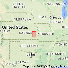
Type locality: in vicinity of Reading, Lyon Co., eastern KS. Well exposed in roadcut near northwest corner sec. 33, T. 17 S., R. 13 E., 1 mi west and 1 mi north of Reading. Thickness is 1.5 to 15 feet, and formation is continuous from southern Nebraska to northern Oklahoma.
Source: US geologic names lexicon (USGS Bull. 896, p. 1779); GNC KS-NE Pennsylvanian Corr. Chart, sheet 2, Oct. 1936.

- Usage in publication:
-
- Reading limestone member*
- Modifications:
-
- Revised
- AAPG geologic province:
-
- Forest City basin
Summary:
Pg. 2274 (fig. 1), 2275. Reading limestone member of Emporia limestone. Rank reduced to member status in Emporia limestone here recognized and used as originally defined. Underlies Harveyville shale member; overlies Auburn shale. Age is Late Pennsylvanian (Virgilian).
Source: US geologic names lexicon (USGS Bull. 1200, p. 3210-3211).
- Usage in publication:
-
- Reading limestone member*
- Modifications:
-
- Areal extent
- AAPG geologic province:
-
- Chautauqua platform
Summary:
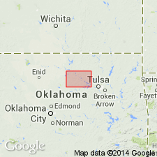
Pg. 56-57. Reading limestone member of Emporia limestone. Described in Pawnee County, where it is 15 to 26 feet thick. Underlies Harveyville shale member; overlies Auburn shale. Unit not easily traced and both northern and southern extremities in county are indistinct. Occurs south of Pawnee County, but southern extent not yet known. Age is Late Pennsylvanian (Virgilian).
Source: US geologic names lexicon (USGS Bull. 1200, p. 3210-3211).

- Usage in publication:
-
- Reading limestone
- Modifications:
-
- Areal extent
Summary:
Pg. 13, fig. 5. Reading limestone of Wabaunsee group. Geographically extended into southwestern Iowa where it is classified as formation in Wabaunsee group. Consists of two beds of gray crinoidal limestone which characteristically weather to deep brown; commonly fossiliferous with crinoid and brachiopod fragments. Thickness about 8 feet. Underlies Harveyville shale; overlies Auburn shale. Age is Late Pennsylvanian (Virgilian).
Source: US geologic names lexicon (USGS Bull. 1200, p. 3210-3211).
For more information, please contact Nancy Stamm, Geologic Names Committee Secretary.
Asterisk (*) indicates published by U.S. Geological Survey authors.
"No current usage" (†) implies that a name has been abandoned or has fallen into disuse. Former usage and, if known, replacement name given in parentheses ( ).
Slash (/) indicates name conflicts with nomenclatural guidelines (CSN, 1933; ACSN, 1961, 1970; NACSN, 1983, 2005, 2021). May be explained within brackets ([ ]).