- Usage in publication:
-
- Rawls Formation
- Modifications:
-
- Geochronologic dating
- AAPG geologic province:
-
- Permian basin
Summary:
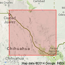
Pg. 5, 21. Rawls Formation. Present in Bofecillos Mountains area, Brewster County, southwestern Texas. "Early Rawls," erupted from Bofecillos volcano; latite porphyry, trachyandesite, and tuff samples yielded K-Ar ages from 28.3 +/-0.6 Ma to 26.9 +/-0.5 Ma (alkali feldspar, whole-rock). Small intrusion within Solitario, but probably related to adjacent Bofecillos volcano; olivine syenite sample yielded a K-Ar age of 27.0 +/-0.5 Ma (whole-rock). Central intrusion; diorite sample yielded a K-Ar age of 26.8 +/-0.4 Ma (biotite). "Member 9"; basalt samples yielded K-Ar ages from 23.6 +/-0.5 Ma to 18.0 +/-0.4 Ma (whole-rock). Data from J.W. Dietrich, 1966 (Univ. Texas-Austin Bur. Econ. Geol., Geol. Quad. Map No. 28), C.D. Henry and J.G. Price, 1986 (Jour. Geophysical Res., v. 91), J.T. Lonsdale, 1940 (GSA Bull., v. 51, p. 1539-1626), J.F. McKnight, 1970 (Univ. Texas-Austin Bur. Econ. Geol., Geol. Quad. Map No. 37), and J.A. Wilson, 1980 (New Mexico Geol. Soc. 31st Field Conf. Gdbk., p. 205-211); ages recalculated using decay constants of Steiger and Jager, 1977 (Earth Planet. Sci. Letters, v. 36, p. 359-362).
[Age considered Oligocene to Miocene; Oligocene-Miocene boundary 23.7 (26-23) Ma (from Geologic Names Committee, USGS, 1983 ed. geol. time scale, with additions from N.J. Snelling, 1985, The Geol. Soc. Mem., no. 10).]
Source: Publication.
For more information, please contact Nancy Stamm, Geologic Names Committee Secretary.
Asterisk (*) indicates published by U.S. Geological Survey authors.
"No current usage" (†) implies that a name has been abandoned or has fallen into disuse. Former usage and, if known, replacement name given in parentheses ( ).
Slash (/) indicates name conflicts with nomenclatural guidelines (CSN, 1933; ACSN, 1961, 1970; NACSN, 1983, 2005, 2021). May be explained within brackets ([ ]).

