

- Usage in publication:
-
- Rawlins ash bed
- Modifications:
-
- Original reference
- Dominant lithology:
-
- Volcanic ash
- AAPG geologic province:
-
- Las Animas arch
Summary:
Pg. 244 (fig. 1), 254. Rawlins ash bed of Ash Hollow member of Ogallala formation. Name applied to volcanic ash bed. Thickness 3.5 feet at type locality. Basal 2 feet relatively pure and massive; upper part interbedded with fine to medium sand. Lies about 10 feet above base of Ash Hollow member; lies stratigraphically below Fort Wallace ash bed (new). Present in northwestern Kansas and southwestern Nebraska. Age is Pliocene.
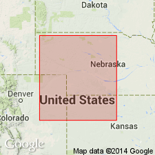
Named from exposures at center of west line of SW/4 sec. 4, T. 4 S., R. 34 W., Rawlins Co., northwestern KS.
[GNC remark (ca. 2010): Ash Hollow Member later discarded by the Kansas Geol. Survey. See Ludvigson and others, 2009, Kansas Geol. Survey Bull., no. 256, pt. 2.]
Source: US geologic names lexicon (USGS Bull. 1200, p. 3207-3208).
For more information, please contact Nancy Stamm, Geologic Names Committee Secretary.
Asterisk (*) indicates published by U.S. Geological Survey authors.
"No current usage" (†) implies that a name has been abandoned or has fallen into disuse. Former usage and, if known, replacement name given in parentheses ( ).
Slash (/) indicates name conflicts with nomenclatural guidelines (CSN, 1933; ACSN, 1961, 1970; NACSN, 1983, 2005, 2021). May be explained within brackets ([ ]).