The National Geologic Map Database is migrating to a new infrastructure. We apologize for any service disruptions during this process.
|
|---|


- Usage in publication:
-
- Rattlesnake formation
- Modifications:
-
- Original reference
- Dominant lithology:
-
- Gravel
- Ash
- Tuff
- Lava
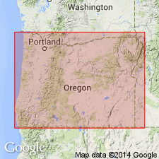
- AAPG geologic province:
-
- Snake River basin
Summary:
Pg. 310. Rattlesnake formation. Gravels, ash, tuff, and rhyolitic lava; mainly gravels derived from Columbia [River] lava. Sometimes confused with Mascall formation. Type exposure on Rattlesnake Creek about 1 mile west of Cottonwood. Includes (descending): gravel, 100 feet; rhyolite, 30 feet; soft brown tuff, 25 feet; coarse basal gravels, 30 to 200 feet. Unconformably overlies Mascall formation (upper Miocene). Cannot be older than early or middle Pliocene and cannot be later than Pliocene.
Source: U.S. geologic names lexicon (USGS Bull. 896, p. 1776).
- Usage in publication:
-
- Rattlesnake formation*
- Modifications:
-
- Overview
- AAPG geologic province:
-
- Snake River basin
Summary:
Rattlesnake formation appears to be of fluviatile origin in large part. [Age considered Pliocene.]
Source: U.S. geologic names lexicon (USGS Bull. 896, p. 1776).
- Usage in publication:
-
- Rattlesnake
- Modifications:
-
- Areal extent
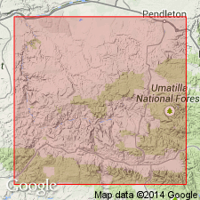
- AAPG geologic province:
-
- Snake River basin
Wilkinson, W.D., 1950, Welded tuff member of the Rattlesnake formation [Oregon] [abs.]: Geological Society of America Bulletin, v. 61, no. 12, pt. 2, p. 1534.
Summary:
Rattlesnake formation. Contains layer of welded tuff that stands in cliffs 50 to 75 feet high and extends from type locality near Picture Gorge eastward along both sides of John Day Valley to vicinity of town of John Day. [Age considered Pliocene and Pleistocene.]
Source: U.S. geologic names lexicon (USGS Bull. 1200, p. 3204-3205).
- Usage in publication:
-
- Rattlesnake formation*
- Modifications:
-
- Mapped 1:62.5k
- Dominant lithology:
-
- Fanglomerate
- Gravel
- Sand
- Clay
- Tuff
- AAPG geologic province:
-
- Snake River basin
Summary:
Also USGS Min. Inv. Field Studies Maps MF-50 (Mount Vernon quadrangle) and MF-51 (John Day quadrangle).
Rattlesnake Formation. In Aldrich Mountain quadrangle and Mount Vernon quadrangle, overlies Mascall formation with angular unconformity. In John Day quadrangle overlies Columbia River basalt with angular unconformity. Age is Pliocene and Pleistocene (?).
Source: U.S. geologic names lexicon (USGS Bull. 1200, p. 3204-3205).

- Usage in publication:
-
- Rattlesnake formation*
- Modifications:
-
- Age modified
- AAPG geologic province:
-
- Snake River basin
Summary:
Rattlesnake formation. Consists of fanglomerate, boulder gravel, and welded rhyolite tuff. Gravels and about 15 feet of tuff near the center form a 650-foot bluff southeast of Dayville and extend below floor of valley. Tuff member has maximum thickness of about 110 feet. Vertebrate fossils below tuff date beds below tuff as [early] Pliocene; beds above tuff range up to Pleistocene in age.
Source: U.S. geologic names lexicon (USGS Bull. 1200, p. 3204-3205).
- Usage in publication:
-
- Rattlesnake Formation*
- Modifications:
-
- Age modified
- Geochronologic dating
- Paleomagnetics
- AAPG geologic province:
-
- Snake River basin
Prothero, D.R., Hoffman, J.M., and Foss, S.E., 2006, Magnetic stratigraphy of the upper Miocene (Hemphillian) Rattlesnake Formation, central Oregon: University of California Museum of Paleontology, Paleobios, v. 26, no. 1, p. 21-26.
Summary:
Rattlesnake Formation. Paleomagnetic samples were collected from the type locality of the Rattlesnake Formation. Samples indicate the Rattlesnake is almost entirely of reversed magnetic polarity and probably is correlative with magnetic Chrons C3Br2n to C3Bn (about 7.3 to 6.9 Ma). Age is late Miocene {late early Hemphillian NALMA).
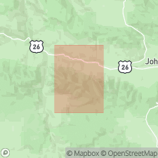
Type locality (sensu Merriam, 1901): between Rattlesnake and Cottonwood Creeks, 2 km south of Picture Gorge, in NW/4 SE/4 NE/4 SW/4 sec. 19, T. 11 S., R. 26 E.; [approx. Lat. 44 deg. 30 min. 44 sec. N., Long. 119 deg. 38 min. 41 sec. W.]; UTM Zone 11, NAD27, 289,782 m E., 4,931,979 m N.; Picture Gorge 7.5-min quadrangle, Grant Co., OR (see also Retallack and others, 2002, Palaeogeog., Palaeoclim., Palaeoecol., v. 183, p. 329-354).
[Additional locality information from USGS historical topographic map collection TopoView; accessed October 24, 2022.]
Source: Publication.
For more information, please contact Nancy Stamm, Geologic Names Committee Secretary.
Asterisk (*) indicates published by U.S. Geological Survey authors.
"No current usage" (†) implies that a name has been abandoned or has fallen into disuse. Former usage and, if known, replacement name given in parentheses ( ).
Slash (/) indicates name conflicts with nomenclatural guidelines (CSN, 1933; ACSN, 1961, 1970; NACSN, 1983, 2005, 2021). May be explained within brackets ([ ]).