

- Usage in publication:
-
- Rattlesnake beds
- Modifications:
-
- Named
- Dominant lithology:
-
- Sandstone
- Silt
- Clay
- AAPG geologic province:
-
- Permian basin
Summary:
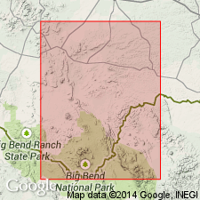
Named as formation for Rattlesnake Mountain, a dissected low dome on east side of lower Terlingua Creek and about 4 mi south of Big Bend PO, southern Brewster Co, TX in Permian basin. Type not designated. Beds are exposed in almost continuous but irregular belt encircling Chisos Mountains, and vary in width from less than a mi to several mi. Unit consists of fossiliferous sandstone, muddy and peaty clay and silt, some limestone, and some thin gravel beds. Sandstone (the most conspicuous lithology) is well-sorted, rather little rounded, fine-grained quartz with some magnetite; color may be white, gray, yellow, brown, and blue; single beds are as much as 50 and 60 ft thick; thin bedding prevails, with cross-bedding and ripple-bedded layers common; calcareous cement. Finer interbedded sediments consist of silts in lower part and clay in upper part, both sometimes calcareous, and together constitute the bulk of the unit. Measured sections presented in vicinity of Chisos Pen. Lower 100 ft gradational with Terlingua beds (new) below. Gradational contact with Tornillo clays (new) above. Thickness about 600 ft. Interpreted as littoral deposits. Abundant fossils listed. Age is Late Cretaceous; vertebrate fossils (dinosaurs) indicate near top of Cretaceous.
Source: GNU records (USGS DDS-6; Denver GNULEX).

- Usage in publication:
-
- Rattlesnake formation†
- Modifications:
-
- Abandoned
- AAPG geologic province:
-
- Permian basin
Summary:
Pg. 505. †Rattlesnake formation. Introduced Aguja formation, to replace Rattlesnake formation, preoccupied by Pliocene formation in Oregon [See entry under Aguja.]
Source: US geologic names lexicon (USGS Bull. 896, p. 1776).
For more information, please contact Nancy Stamm, Geologic Names Committee Secretary.
Asterisk (*) indicates published by U.S. Geological Survey authors.
"No current usage" (†) implies that a name has been abandoned or has fallen into disuse. Former usage and, if known, replacement name given in parentheses ( ).
Slash (/) indicates name conflicts with nomenclatural guidelines (CSN, 1933; ACSN, 1961, 1970; NACSN, 1983, 2005, 2021). May be explained within brackets ([ ]).