

- Usage in publication:
-
- Ratcliffe beds
- Modifications:
-
- Named
- Dominant lithology:
-
- Anhydrite
- Mudstone
- AAPG geologic province:
-
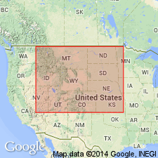
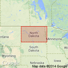
- Williston basin
Summary:
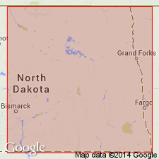
An informal subdivision of the Madison Group used in the subsurface in the northeast part of the Williston basin, MT, ND, Saskatchewan, and Manitoba, based on correlation of widespread mechanical-log marker horizons. Named for the Socony Central Le duc Del Rio Ratcliffe No. 1 well, Lsd. 5, sec 30, T1, R15, West 2nd Meridian, Saskatchewan, where it lies between 6,347 ft and 6,496 ft. Bounded below by the uppermost argillaceous band of the Midale beds and above by the base of an evaporitic anhydrite underlying the 100-ft thick interval of anhydrites and mudstones which includes the "last" or lower "Charles" salt of the Nesson anticline area of ND. These units at the base of overlying Poplar beds. Mississippian in age.
Source: GNU records (USGS DDS-6; Denver GNULEX).
- Usage in publication:
-
- Ratcliffe beds
- Modifications:
-
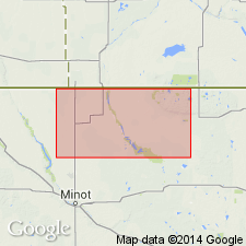
- Areal extent
- AAPG geologic province:
-
- Williston basin
Summary:
An informal subdivision of the Madison group, based on radioactivity- and electrical-log characteristics. Used in the sense of Anderson (1958) in parts of Renville, Bottineau and McHenry Cos, north-central ND in the Williston basin. Boundaries shown on a log of the Carter-Phillips, G. Blower no. 1 well, SE1/4 SW1/4 sec 20, T160N [T161N], R83W. Overlain by the Poplar beds; underlain by the Midale beds. Mississippian in age.
Source: GNU records (USGS DDS-6; Denver GNULEX).
- Usage in publication:
-
- Ratcliffe beds
- Modifications:
-
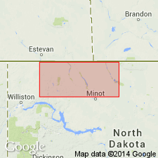
- Areal extent
- AAPG geologic province:
-
- Williston basin
Summary:
Revised as an informal subdivision of the Madison group, based on radioactivity- and electric-log correlations. Used in northwestern ND in the Williston basin. Lower contact revised upward to exclude the Midale Evaporite of Fuller [J.G.C.M., 1956, Mississippian rocks and oil fields in southern Saskatchewan: Saskatchewan Department Mineral Resources Report 19]; upper contact defined in the sense of the Saskatchewan Geological Society (1956). Shows correlations in oil and gas wells in cross sections extending from Divide Co eastward to Bottineau Co, and from Williams Co eastward to Bottineau Co, ND. Overlain by the Poplar beds; underlain by the Midale beds. Mississippian in age.
Source: GNU records (USGS DDS-6; Denver GNULEX).
- Usage in publication:
-
- Ratcliffe interval
- Modifications:
-
- Revised
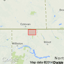
- Areal extent
- AAPG geologic province:
-
- Williston basin
Summary:
Pg. 4 (fig. 3), 12, 14-15. Ratcliffe interval (informal) of Madison group. Defined by mechanical-log markers. Present in subsurface of the Williston basin, North Dakota. Consists of light-brownish-gray fragmental limestone (in part pelletoidal) and anhydrite with minor amounts of salt and gray shale. Upper contact raised to include lower part of Poplar beds (of the Saskatchewan Geological Society, 1956, and Anderson, 1958). Lower contact lowered to include the Midale beds of Anderson and Carlson (1958); these rocks are here referred to as the Midale subinterval (informal) of the Ratcliffe. Underlies the redefined Poplar interval (informal) of Madison group; overlies Rivil subinterval (informal) of Frobisher-Alida interval (informal) of Madison group. Age is Mississippian. Electric- and radioactivity-log of the interval shown for the Pan American, B. Staaleson No. 1 well, in NW/4 NE/4 sec. 6, T. 162 N., R. 91 W., Burke Co., ND, and in five mechanical-log cross sections in Burke Co., ND.
Source: Publication; GNU records (USGS DDS-6; Denver GNULEX).
- Usage in publication:
-
- Ratcliffe interval
- Modifications:
-
- Overview
- AAPG geologic province:
-
- Williston basin
Summary:
Ratcliffe interval (informal) of Madison group. Defined by mechanical-log markers; boundaries are same as those defined by Anderson and others (1960). Present in subsurface of the Williston basin, North Dakota. Includes Midale subinterval (informal) in the basal part. Thickness about 200 feet. Underlying beds not discussed; overlain by Midale subinterval (informal) of Rivil subinterval (informal) of Frobisher-Alida interval (informal) of Madison group. Age is Mississippian. Electric-log characteristics shown for the Carter-Phillips, G. Blower No. 1 well, in SE/4 SW/4 sec. 20, T. 160 N., R. 83 W., Bottineau Co., ND, and on a detailed electric- and radioactivity-log correlation diagram extending from Renville Co., ND, southward to Sioux Co., ND.
Source: Modified from GNU records (USGS DDS-6; Denver GNULEX).
- Usage in publication:
-
- Ratcliffe interval
- Modifications:
-
- Overview
- AAPG geologic province:
-
- Williston basin
Summary:
Ratcliffe interval (informal) of Madison Group. Defined by mechanical-log markers. Present in subsurface of the Williston basin, North Dakota. Compares usage of the term by some previous authors in North Dakota and southeastern Saskatchewan. Summarizes lithologic and stratigraphic relations. Age is early Late Mississippian (Meramecian), based on correlation with equivalent rocks in Canada. Electric-log characteristics shown for the Carter Oil Company, E.L. Semling No. 1 well, in sec. 18, T. 141 N., R. 81 W., Oliver Co., ND. Report also includes isopach map.
Source: Modified from GNU records (USGS DDS-6; Denver GNULEX).
For more information, please contact Nancy Stamm, Geologic Names Committee Secretary.
Asterisk (*) indicates published by U.S. Geological Survey authors.
"No current usage" (†) implies that a name has been abandoned or has fallen into disuse. Former usage and, if known, replacement name given in parentheses ( ).
Slash (/) indicates name conflicts with nomenclatural guidelines (CSN, 1933; ACSN, 1961, 1970; NACSN, 1983, 2005, 2021). May be explained within brackets ([ ]).