The National Geologic Map Database is migrating to a new infrastructure. We apologize for any service disruptions during this process.
|
|---|


- Usage in publication:
-
- Ranegras member
- Modifications:
-
- First used
- Dominant lithology:
-
- Sandstone
- Siltstone
- Shale
- Conglomerate
- AAPG geologic province:
-
- Basin-and-Range province
Summary:
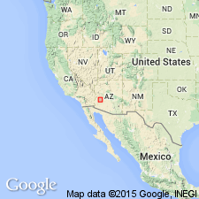
First published use as the informal basal member of McCoy Mountains Formation [formal] in the Harquar plate in southern Little Harquahala and western Harquahala Mountains, La Paz Co, AZ in the Basin-and-Range province. Intent to name, source of geographic name, designation of a type not stated. Overlies Black Rock volcanics (first used, informal term) depositionally. Occurs in a fault bounded block; relationship to the unnamed member of the McCoy Mountains Formation not clear because of complex folding and faulting. Consists of basal ledgy part of interbedded quartzose sandstone, maroon to purple siltstone or shale and cobble conglomerate. Several puddingstone conglomerates (well rounded pebbles and cobbles of pink vitreous quartzite, maroon feldspathic quartzite, sparse red jasper, rare limestone and silicic volcanic rocks in a matrix of coarse-grained feldspathic sandstone) occur as beds 10-30 m thick. The upper part is conglomeratic feldspathic quartz arenite with sparse purple siltstone and quartzite-cobble conglomerate. May have been deposited in a meandering fluvial system. Geologic maps. Stratigraphic section. Assigned to the Jurassic and Cretaceous.
Source: GNU records (USGS DDS-6; Denver GNULEX).
For more information, please contact Nancy Stamm, Geologic Names Committee Secretary.
Asterisk (*) indicates published by U.S. Geological Survey authors.
"No current usage" (†) implies that a name has been abandoned or has fallen into disuse. Former usage and, if known, replacement name given in parentheses ( ).
Slash (/) indicates name conflicts with nomenclatural guidelines (CSN, 1933; ACSN, 1961, 1970; NACSN, 1983, 2005, 2021). May be explained within brackets ([ ]).