- Usage in publication:
-
- Randlett horizon
- Modifications:
-
- Original reference
- Dominant lithology:
-
- Clay
- Sandstone
- AAPG geologic province:
-
- Uinta basin
Summary:
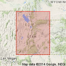
Pg. 357-359. Randlett horizon in Duchesne River formation. To facilitate correlation and reference of specimens now in Carnegie Museum, Duchesne River formation, in eastern Utah, is divided into 3 horizons, from lowest to highest, the Randlett, the Halfway, and the Lapoint. Type Iocality of Randlett horizon is north and east of town of that name, and it consists of 478.5 feet of brown, red, bluish-gray, and variegated clays alternating with brown and gray sandstones. These beds are capped by a 10-foot stratum of conglomerate, which is taken as base of Halfway horizon. Latter horizon is well exposed along Halfway Hollow, the basin which drains that district in T. 4 and 5 S., between R. 19 and 20 E., Salt Lake meridian. There are 557.5 feet of sediments, chiefly sandstones and shales with several conglomerate members, referred to Halfway horizon. The sandstones in general are coarser than those of the Randlett. Overlying the Halfway horizon is 22 feet of bluish-white clay, which can be seen just north of Vemal-Lapoint road and which is quite persistent throughout the area. This is considered basal member of Lapoint horizon, the uppermost division of Duchesne River formation. The Lapoint horizon is typically seen along head of Halfway Hollow east and north of town of Lapoint. The Lapoint includes 336 feet of conglomeratic sandstones, sandy clays, and coarse conglomerates. Age is Oligocene.
Source: US geologic names lexicon (USGS Bull. 896, p. 1770).
For more information, please contact Nancy Stamm, Geologic Names Committee Secretary.
Asterisk (*) indicates published by U.S. Geological Survey authors.
"No current usage" (†) implies that a name has been abandoned or has fallen into disuse. Former usage and, if known, replacement name given in parentheses ( ).
Slash (/) indicates name conflicts with nomenclatural guidelines (CSN, 1933; ACSN, 1961, 1970; NACSN, 1983, 2005, 2021). May be explained within brackets ([ ]).

