The National Geologic Map Database is migrating to a new infrastructure. We apologize for any service disruptions during this process.
|
|---|


- Usage in publication:
-
- Ramsey Ranch Member
- Modifications:
-
- Named
- Dominant lithology:
-
- Limestone
- Shale
- Mudstone
- Sandstone
- Lignite
- AAPG geologic province:
-
- Green River basin
Summary:
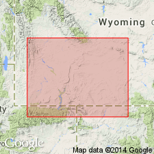
Named as lowermost member of Green River Formation. Type section designated in valley of Sage Creek in secs 13, 14, 22, and 23, T14N, R105W, about 2 mi south of Ramsey Ranch buildings, for which unit is probably named, Sweetwater Co, WY, Greater Green River basin. Ramsey Ranch and its equivalents occur north of Uinta Mountains within parts of Rock Springs uplift, Washakie Basin and Great Divide Basin. Consists of mostly shallow-water lacustrine beds interbedded with some dark-colored beds of non-red bed fluviatile and paludal origin. Weathers drab-gray and forms a series of low ridges capped by fossiliferous limestones and sandstones. Composed of gray to black, coquinal limestones, dark-gray to black shales, chocolate-brown, fissile shales, green mudstones, and gray, fine-grained sandstones. Carbonaceous shales and lignites are present in some horizons. Unit is 920 ft thick at type; thickens a few mi to north along Sage Creek and in subsurface to west, north of Uinta Mountains. Strata assigned to unit found throughout main body of Wasatch Formation from directly below Luman Member of Green River to within 70 ft of underlying Fort Union Formation. Overlies Nightingale Member (new) of Wasatch; underlies unnamed tongue of Wasatch. Chart showing previous nomenclature; restored section; map of areal extent. Assigned early Eocene age.
Source: GNU records (USGS DDS-6; Denver GNULEX).
- Usage in publication:
-
- Ramsey Ranch Member*
- Modifications:
-
- Overview
- Areal extent
- AAPG geologic province:
-
- Green River basin
Summary:
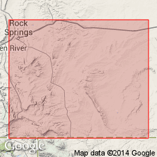
Occurs in upper part of main body of Wasatch Formation. Areal limits map shows that unit extends from north of Uinta Mountains eastward across southern tip of Rock Springs uplift and northeastward across Washakie basin into Great Divide basin. Five measured sections are described within Sweetwater Co, WY, Greater Green River basin. At Sage Creek (measured section A; T14N, R105W) unit is 542 ft thick and consists of gray and green and some red fluvial (flood-plain) deposits and interbedded fossiliferous lacustrine oil shale and limestone and paludal carbonaceous shale and coal deposits as well as gray and green fluvial (flood-plain) deposits consisting of stream channel and splay sandstone and interdistributary mudstone. At Little Mountain (measured section B; T13N, R105W) unit is 121 ft thick and consists of mixed fluvial, paludal, and lacustrine deposits. At West Hiawatha (measured section C; T12N, R100W) unit is 413 ft thick and consists of fluvial, paludal, and lacustrine rocks. At Rife Rim (measured section D; T14N, R101W) unit is 580 ft thick and is mostly fluvial (flood-plain) deposits in middle part becoming mostly paludal and lacustrine at bottom and top parts. At Tipton Buttes (measured section E; T20N, R96W and T21N, R95W) unit is an interbedded mixture of fluvial (flood-plain), paludal, and lacustrine rocks and contains thick sequences of oil shale. Conformably underlies Luman Tongue of Green River Formation. Eocene age.
Source: GNU records (USGS DDS-6; Denver GNULEX).
- Usage in publication:
-
- Ramsey Ranch Member*
- Modifications:
-
- Revised
- Areal extent
- Overview
- AAPG geologic province:
-
- Green River basin
Summary:
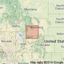
Reassigned as member in upper part of main body of Wasatch Formation. Originally named as member of Green River Formation, however, as other workers believed that Ramsey Ranch does not contain sufficient lacustrine rocks for it to be included in the Green River, it is here reassigned to the Wasatch. Isopach map showing areal extent within Greater Green River basin, WY and CO. Ramsey Ranch was deposited in Uinta Mountain trough and in a lobe of the trough that projected southeast from the trough around east end of Uinta Mountains. Lakes that were present in Uinta Mountain trough during deposition of Ramsey Ranch represent embryonic stages of deposition of Green River Formation in Lake Gosiute. Ramsey Ranch has maximum thickness of 800 ft near center of Washakie basin; thins westward to less than 400 ft across southern plunge of axis of Rock Springs uplift, then thickens to more than 600 ft along northern flank of Uinta Mountains. Contains important deposits of shale oil, uranium, and coal that are generally absent in other parts of main body. Stratigraphic chart; cross sections. Eocene age.
Source: GNU records (USGS DDS-6; Denver GNULEX).
- Usage in publication:
-
- Ramsey Ranch Member*
- Modifications:
-
- Overview
- AAPG geologic province:
-
- Green River basin
Summary:
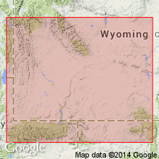
Paleographic map (fig. 45) of this upper member of Wasatch Formation showing depositional environments in Greater Green River basin. At stratigraphic position of 350 ft below base of overlying Luman Tongue of Green River Formation, depositional environment was deep freshwater lake occupying 850 sq mi of Uinta Mountain trough in eastern part of Greater Green River basin. Surrounding this lake and extending southward and westward were swamps, small shallow lakes, and numerous ponds in which carbonaceous shale, coal, oil shale, and limestone were deposited. Lacustrine rocks represent embryonic stage of ancient Lake Gosiute which occupied about 6650 sq mi during deposition of Luman Tongue. Overlies, and to north and south of Uinta trough, intertongues with main body of Wasatch; near northeast corner of basin intertongues with and is replaced by Battle Spring Formation. Generalized stratigraphic correlation chart. Eocene age.
Source: GNU records (USGS DDS-6; Denver GNULEX).
For more information, please contact Nancy Stamm, Geologic Names Committee Secretary.
Asterisk (*) indicates published by U.S. Geological Survey authors.
"No current usage" (†) implies that a name has been abandoned or has fallen into disuse. Former usage and, if known, replacement name given in parentheses ( ).
Slash (/) indicates name conflicts with nomenclatural guidelines (CSN, 1933; ACSN, 1961, 1970; NACSN, 1983, 2005, 2021). May be explained within brackets ([ ]).