The National Geologic Map Database is migrating to a new infrastructure. We apologize for any service disruptions during this process.
|
|---|


- Usage in publication:
-
- Ralston formation
- Modifications:
-
- Principal reference
- Dominant lithology:
-
- Shale
- Marlstone
- Sandstone
- Gypsum
- AAPG geologic province:
-
- Denver basin
Summary:
Pg. 46-55. Ralston formation. Represented by two lateral lithic variations: a shale-marlstone facies and a gypsiferous facies. Former facies essentially gray to maroon shales. Thin dense gray impure lithographic to sandy marlstones, and fine- to medium-grained yellow to buff calcareous sandstones and silts commonly present as minor components. Marlstones best developed near Mount Vernon Canyon where they are conspicuously laminated and arenaceous. Bedding moderately uniform. Thickness at type section 83 feet. Gypsiferous facies essentially of thin beds of white massive to fibrous gypsum and numerous thin layers of gypsiferous silt. Several conspicuous beds of hard massive yellow calcareous medium-grained sandstone and minor amounts of thin-bedded maroon shale in upper part of facies. Thickness at type section 67.5 feet. Formation disconformably underlies basal sandstone of Morrison; overlies Lykins formation. [Age is Late Jurassic.]
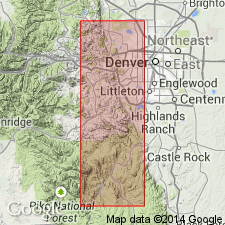
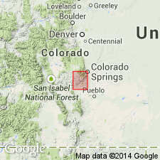
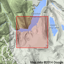
Type section of shale-marlstone facies: along irrigation ditch and water level on west side of Ralston Reservoir, Ralston Creek, 5 miles north of Golden, in sec. 5, T. 3 S., R. 70 W., Blackhawk quadrangle, Jefferson Co., north-central CO. Facies prevalent between Bear Creek and Ralston Creek.
Type section of gypsiferous facies: on east side of Glennon Canyon, 1.5 mi southeast of Morrison, in NW/4 sec. 12, T. 5 S., R. 70 W., Morrison quadrangle, Jefferson Co., north-central CO. Facies well exposed along west slope of Dakota hogback between Bear Creek and Turkey Creek.
Source: US geologic names lexicon (USGS Bull. 1200, p. 3193-3194).
- Usage in publication:
-
- Ralston formation
- Modifications:
-
- Areal extent
- AAPG geologic province:
-
- Denver basin
Summary:
Pg. 2120-2147. Ralston Formation. Four sedimentary facies recognized in Canon City embayment [Freemont and El Paso Counties]: conglomerate facies, sandstone facies, gypsum-shale facies, and sand-shale facies. These are intergradational from west to east. Shale-marlstone and gypsum facies of Golden-Morrison area (of LeRoy) considered equivalent respectively to sand-shale and gypsum-shale facies of this paper. Thickness in embayment from fraction of a foot to as much as 180 feet. [Age is Late Jurassic.]
Source: US geologic names lexicon (USGS Bull. 1200, p. 3193-3194).
- Usage in publication:
-
- Ralston formation[†]
- Modifications:
-
- [Abandoned]
- AAPG geologic province:
-
- Denver basin
Summary:
Pg. 755-756. Proposed that rocks that LeRoy (1946) described as Ralston formation be renamed Ralston Creek formation because the former name had been applied to two other units at the time LeRoy published his paper-one of which had its type locality only a few miles from LeRoy's type section. Age is Late Jurassic.
Source: US geologic names lexicon (USGS Bull. 1200, p. 3193-3194).
For more information, please contact Nancy Stamm, Geologic Names Committee Secretary.
Asterisk (*) indicates published by U.S. Geological Survey authors.
"No current usage" (†) implies that a name has been abandoned or has fallen into disuse. Former usage and, if known, replacement name given in parentheses ( ).
Slash (/) indicates name conflicts with nomenclatural guidelines (CSN, 1933; ACSN, 1961, 1970; NACSN, 1983, 2005, 2021). May be explained within brackets ([ ]).