The National Geologic Map Database is migrating to a new infrastructure. We apologize for any service disruptions during this process.
|
|---|


- Usage in publication:
-
- Raiff limestone
- Modifications:
-
- Original reference
- Dominant lithology:
-
- Limestone
- Dolomite
- Shale
- AAPG geologic province:
-
- Great Basin province
Summary:
Pg. 159-160; geol. map. Raiff limestone. At type section (directly above that of the Monte Neva formation), consists of 2,789 feet of limestones. Informally subdivided into (ascending): A member, 1,456 feet thick, cliff-forming limestone with dolomite about 250 feet from top; B member, about 269 feet thick, thin-bedded limestone and subordinate olive-drab shale; C member, 1,064 feet, characterized by two cliff-forming units separated by a shaly unit, lower cliff is limestone and upper cliff is interlayered limestone and dolomite. Overlies Monte Neva formation (new); underlies Dunderberg formation. Age is Cambrian.
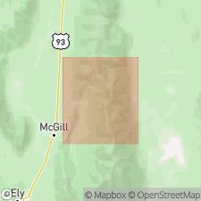
Type section: on the divide north of the third large canyon [now called Pluto Canyon], northwest of Monte Neva Hot Springs, in NW/4 sec. 33, T. 22 N., R. 63 E., [approx. Lat. 39 deg. 44 min. N., Long. 114 deg. 51 min. W., Monte Neva Hot Springs 7.5-min quadrangle], northern Egan Range, White Pine Co., eastern NV. Named from Raiff Siding on Nevada Northern RR, 3 mi east-northeast of type section [in adjacent Borchert Spring 7.5-min quadrangle].
[Additional locality information from USGS historical topographic map collection TopoView, accessed February 2, 2023.]
Source: Publication; US geologic names lexicon (USGS Bull. 1200, p. 3189).
For more information, please contact Nancy Stamm, Geologic Names Committee Secretary.
Asterisk (*) indicates published by U.S. Geological Survey authors.
"No current usage" (†) implies that a name has been abandoned or has fallen into disuse. Former usage and, if known, replacement name given in parentheses ( ).
Slash (/) indicates name conflicts with nomenclatural guidelines (CSN, 1933; ACSN, 1961, 1970; NACSN, 1983, 2005, 2021). May be explained within brackets ([ ]).