The National Geologic Map Database is migrating to a new infrastructure. We apologize for any service disruptions during this process.
|
|---|


- Usage in publication:
-
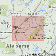
- Ragland sandstone
- Modifications:
-
- Named
- Dominant lithology:
-
- Sandstone
- AAPG geologic province:
-
- Appalachian basin
Summary:
Name Ragland sandstone applied to sandstones of Hamilton age in St. Clair Co., central AL. Strata was previously included in Frog Mountain sandstone. At type locality, the formation is unconformably overlain by Fort Payne chert and unconformably underlain by Little Oak limestone. It consists of (ascending) 1) 1 ft of coarsely crystalline, dark, sandy, fossiliferous limestone; 2) 0.5 ft of dark fossiliferous, argillaceous shale; 3) 1.5 ft of hard, fine-grained calcareous, fossiliferous sandstone; 4) 2.5 ft of highly fossiliferous brown, rotten, ferruginous sandstone and shale; and 5) 48 ft of thick-bedded sandstone, some layers coarse-grained, others fine-grained with nodular chert-like bands, some dark shale, and scattered fossils. [See also Butts (1927: Washington Acad. Science Jour., v. 17, p. 128-129) and Butts (1927: U.S. Geological Survey Atlas, Folio 221, p. 9).]
Source: GNU records (USGS DDS-6; Reston GNULEX).
- Usage in publication:
-
- Ragland sandstone
- Modifications:
-
- Biostratigraphic dating
- AAPG geologic province:
-
- Appalachian basin
Summary:
Ragland sandstone is tentatively correlated with MERISTELLA-Coral zone of Schoharie Valley sequence occurring about 250 ft above Onondaga limestone and containing "SPIRIFER" VENUSTUS. Shown on chart as younger than Frog Mountain sandstone.
Source: GNU records (USGS DDS-6; Reston GNULEX).
For more information, please contact Nancy Stamm, Geologic Names Committee Secretary.
Asterisk (*) indicates published by U.S. Geological Survey authors.
"No current usage" (†) implies that a name has been abandoned or has fallen into disuse. Former usage and, if known, replacement name given in parentheses ( ).
Slash (/) indicates name conflicts with nomenclatural guidelines (CSN, 1933; ACSN, 1961, 1970; NACSN, 1983, 2005, 2021). May be explained within brackets ([ ]).