The National Geologic Map Database is migrating to a new infrastructure. We apologize for any service disruptions during this process.
|
|---|


- Usage in publication:
-
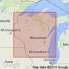
- Racine limestone
- Modifications:
-
- Named
- Dominant lithology:
-
- Dolomite
- Limestone
- AAPG geologic province:
-
- Wisconsin arch
Summary:
Named the Racine limestone in southeastern WI and northeastern IL for Racine, Racine Co., WI. Consists of friable, yellow or ocherous limestone, gray or buff colored, crystalline, very tough and compact, extremely porous, magnesian limestone. Thickness is 250 to 500 ft. Absent in southwestern WI. Overlies Waukesha limestone. Contains Niagaran fossils. The Racine is of Silurian age.
Source: GNU records (USGS DDS-6; Reston GNULEX).
- Usage in publication:
-
- Racine Formation
- Modifications:
-
- Areal extent
- Not used
- AAPG geologic province:
-
- Wisconsin arch
Summary:
According to author, one of his primary aims in this report is to strongly encourage adoption of IA nomenclature in adjacent IL. The only major change is the incorporation of the Sweeney and Marcus as members within the Hopkinton and replacement of the Racine with upper members of the Hopkinton (Farmers Creek and Picture Rock Members), the Scotch Grove Formation, and the Gower Formation. Witzke (1992) suggested that Racine had misapplied in northeastern IL by Willman (1973). Much of Willman's "Racine" correlates with pre-Racine strata to the east (Joliet Formation and its equivalents). Only the upper part of the Scotch Grove, with its distinctive mound facies, may actually correlate with part of the typical Racine. The Gower Formation of eastern IA and adjacent IL probably correlates with part of the lower and middle Racine of eastern WI and has historic precedence in the area.
Source: GNU records (USGS DDS-6; Reston GNULEX).
For more information, please contact Nancy Stamm, Geologic Names Committee Secretary.
Asterisk (*) indicates published by U.S. Geological Survey authors.
"No current usage" (†) implies that a name has been abandoned or has fallen into disuse. Former usage and, if known, replacement name given in parentheses ( ).
Slash (/) indicates name conflicts with nomenclatural guidelines (CSN, 1933; ACSN, 1961, 1970; NACSN, 1983, 2005, 2021). May be explained within brackets ([ ]).