The National Geologic Map Database is migrating to a new infrastructure. We apologize for any service disruptions during this process.
|
|---|


- Usage in publication:
-
- Raben Branch bed
- Modifications:
-
- Original reference
- AAPG geologic province:
-
- Illinois basin
Summary:
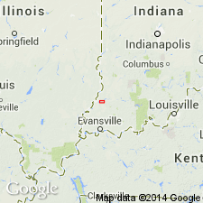
Pg. 132, 133 (fig. 2) [1948]. Rabens Branch bed of Parkers formation. Fossiliferous clay band or ferrous carbonate band about 1 inch thick that overlies a thin coal bed near base of formation; horizon is about 20 feet below the Parkers coal and its black sheety shale. [Age is Late Pennsylvanian.]
Named from exposure on Rabens Branch, a small stream crossing the north-south road about 0.25 mi south of center of sec. 11, T. 5 S., R. 12 W., 1.5 mi southwest of St. Wendells, Posey Co., IL.
Source: US geologic names lexicon (USGS Bull. 1200, p. 3185).
For more information, please contact Nancy Stamm, Geologic Names Committee Secretary.
Asterisk (*) indicates published by U.S. Geological Survey authors.
"No current usage" (†) implies that a name has been abandoned or has fallen into disuse. Former usage and, if known, replacement name given in parentheses ( ).
Slash (/) indicates name conflicts with nomenclatural guidelines (CSN, 1933; ACSN, 1961, 1970; NACSN, 1983, 2005, 2021). May be explained within brackets ([ ]).