

- Usage in publication:
-
- Rabbit Lake formation*
- Modifications:
-
- Original reference
- Dominant lithology:
-
- Iron-formation
- AAPG geologic province:
-
- Lake Superior region
Summary:
Pg. 11, 26-30, 33, 40, 61, pls. 1-8. Rabbit Lake formation of Animikie(?) group. Largely gray and black partly ferruginous argillite and slate at least 2,000 feet thick. Contains lenses of lean siliceous argillaceous iron-formation. Overlies Trommald formation (new) of Animikie(?) group. Probably equivalent to Virginia slate of Animikie group in Mesabi and Emily districts. Covered by glacial drift, top not exposed. Age is Precambrian.
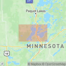
Named for occurrence in vicinity of Rabbit Lake, Crow Wing Co., central MN.
Source: Publication; US geologic names lexicon (USGS Bull. 1350, p. 608).
- Usage in publication:
-
- Rabbit Lake Formation
- Modifications:
-
- Mapped 1:250k
- Revised
- Dominant lithology:
-
- Slate
- Siltstone
- Graywacke
- Iron-formation
- AAPG geologic province:
-
- Lake Superior region
Summary:
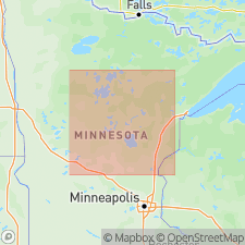
Is mapped as uppermost formation (of 3) of the North Range Group (Early Proterozoic) in Crow Wing County, central MN (Lake Superior region). Is revised in that it had been named by Schmidt (1963) as part of the Animikie? Group and is herein reassigned to the North Range Group. Overlies Trommald Formation of North Range Group. Is interpreted to lie below an unconformity that is correlative with an unconformity at the base of the Animikie Group (Early Proterozoic). Map unit described as gray to very dark-gray slate, siltstone, and very fine-grained graywacke; includes irregularly distributed layers and lenses of carbonaceous slate and also carbonate- and sulfide-facies iron-formation, chiefly in the lower part of the unit. Thickness not given.
Source: GNU records (USGS DDS-6; Denver GNULEX).
For more information, please contact Nancy Stamm, Geologic Names Committee Secretary.
Asterisk (*) indicates published by U.S. Geological Survey authors.
"No current usage" (†) implies that a name has been abandoned or has fallen into disuse. Former usage and, if known, replacement name given in parentheses ( ).
Slash (/) indicates name conflicts with nomenclatural guidelines (CSN, 1933; ACSN, 1961, 1970; NACSN, 1983, 2005, 2021). May be explained within brackets ([ ]).