- Usage in publication:
-
- Quinebaug Formation*
- Modifications:
-
- Named
- Dominant lithology:
-
- Metavolcanics
- Metasedimentary
- Gneiss
- Amphibolite
- AAPG geologic province:
-
- New England province
Summary:
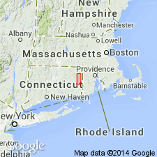
Name Quinebaug Formation given to thick sequence of metamorphosed rocks directly underlying Tatnic Hill Formation (new name). Uppermost part of formation well exposed in steep east-facing cliffs, and contact with overlying Tatnic Hill is at or near top of these cliffs. Base not present in this area, as lowermost rocks are in fault contact with underlying alaskite gneiss and quartzite. Divided into three members: upper and lower (both unnamed) are primarily metavolcanic rocks, and the middle Black Hill Member, metasedimentary rocks. Maximum thickness about 7,000 ft above fault in Plainfield quad. Maximum thickness about 5,000 ft in Danielson quad., but only exposed contact is top of formation. No type locality given for unit as a whole. Age given as pre-Pennsylvanian.
Source: GNU records (USGS DDS-6; Reston GNULEX).

- Usage in publication:
-
- Quinebaug Formation*
- Modifications:
-
- Age modified
- Areal extent
- AAPG geologic province:
-
- New England province
Summary:
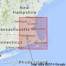
Quinebaug and Tatnic Hill Formations of the Putnam block are equivalent to those in Nashoba block to the north. Age of both, therefore is Proterozoic Z or Ordovician with the Quinebaug also possibly of Cambrian age (equal to Marlboro Formation). Both formations project from CT into Webster area of MA.
Source: GNU records (USGS DDS-6; Reston GNULEX).

- Usage in publication:
-
- Quinebaug Formation*
- Modifications:
-
- Overview
- AAPG geologic province:
-
- New England province
Summary:
Used as Quinebaug Formation of Proterozoic Z, Cambrian, or Ordovician age. Consists of amphibolite, biotite or hornblende gneiss, felsic gneiss, and calc-silicate gneiss.
Source: GNU records (USGS DDS-6; Reston GNULEX).

- Usage in publication:
-
- Quinebaug Formation
- Modifications:
-
- Areal extent
- Overview
- Dominant lithology:
-
- Quartzite
- Marble
- Schist
- AAPG geologic province:
-
- New England province
Summary:
Known outcrop extent of the Quinebaug Formation of the Putnam Group is at least 35 km long and 3.5 km thick. Area could be longer if correlation with the Late Proterozoic Marlboro Formation in MA, as proposed by Goldsmith and other (1982), is valid. Formation also may have been much thicker but original thickness impossible to estimate because of thrust faults above, below, and within. Unit is composed predominantly of mafic gneiss, interlayered with metasedimentary quartzites, marbles, and pelitic schists and more felsic meta-igneous rocks. Bulk compositions are primarily basaltic rather than dacitic. Quinebaug, by far the most mafic unit in report area, is probably unrelated petrologically to units in the Avalon terrane.
Source: GNU records (USGS DDS-6; Reston GNULEX).
For more information, please contact Nancy Stamm, Geologic Names Committee Secretary.
Asterisk (*) indicates published by U.S. Geological Survey authors.
"No current usage" (†) implies that a name has been abandoned or has fallen into disuse. Former usage and, if known, replacement name given in parentheses ( ).
Slash (/) indicates name conflicts with nomenclatural guidelines (CSN, 1933; ACSN, 1961, 1970; NACSN, 1983, 2005, 2021). May be explained within brackets ([ ]).

