

- Usage in publication:
-
- Quichapa group
- Modifications:
-
- Original reference
- Dominant lithology:
-
- Ignimbrite
- AAPG geologic province:
-
- Great Basin province
Summary:
Pg. 16 (fig. 2a), 18-24, 53-57. Quichapa group. Consists of three ignimbrite units in Pine Valley Mountains. Lowermost unit is hard dense welded tuff; pale red violet on fresh surfaces, weathers pale red brown; sparsely scattered through rock are angular red latite(?) fragments, averaging under 10 mm in diameter; ranges in thickness from less than 100 feet just east of Stoddard Mountain to about 800 feet near Pinto Peak; 5 to 20 feet of black glass containing angular red fragments at base of unit. Middle unit is a vitric rhyolite ignimbrite, consisting of strongly welded tuff, contains basal black glass, 10 to 20 feet thick, which unconformably overlies basal unit of group. Uppermost ignimbrite unit is red brown to purplish brown on fresh surfaces, weathers brown or dark brown; basal black glass of unit is as much as 35 feet thick; maximum thickness of unit in Pine Valley Mountains about 550 feet; conformably overlies middle unit. Thickness of group in Pine Valley Mountains ranges from a fraction of a foot to about 1,600 feet, the variation being due largely to an unconformity at top of group. In most exposures, lowermost unit of group appears to overlie Claron formation conformably. Underlies Rencher formation (new). [Age is Oligocene(?).]
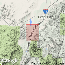
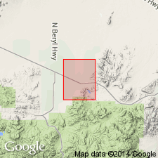
Named from exposures in Quichapa Canyon of the Harmony Hills [Harmony Mountains], Iron and Washington Cos., southwestern UT. Name credited to J.H. Mackin (personal commun.).
Source: US geologic names lexicon (USGS Bull. 1200, p. 3176).
- Usage in publication:
-
- Quichapa formation
- Modifications:
-
- Revised
- AAPG geologic province:
-
- Great Basin province
Summary:
Pg. 18 (fig. 1), 37-40, maps 1 and 2. Quichapa formation. [Revised to include Little Creek breccia.] In Washington County, southwestern Utah, includes (ascending) Leach Canyon tuff, Bauers tuff, Little Creek breccia (new), and Harmony Hills tuff. Thickness 0 to 1,800 feet. Overlies Isom formation; underlies Rencher fo·rmation. Leach Canyon tuff has zircon age of 28 million years; this suggests that formation is Oligocene.
Source: US geologic names lexicon (USGS Bull. 1200, p. 3176).
- Usage in publication:
-
- Quichapa formation
- Modifications:
-
- Revised
- AAPG geologic province:
-
- Great Basin province
Summary:
Pg. 89, 97. Quichapa formation. Rank reduced to formation. Subdivided into (ascending) Leach Canyon tuff, Swett tuff, Bauers tuff, and Harmony Hills tuff members (all new). Underlies Rencher formation; overlies Isom formation (new). [Age is Oligocene(?).]
Source: US geologic names lexicon (USGS Bull. 1200, p. 3176).
- Usage in publication:
-
- Quichapa Formation*
- Modifications:
-
- Adopted
- AAPG geologic province:
-
- Great Basin province
Summary:
The Leach Canyon Tuff, Bauers Tuff, and Harmony Hills Tuff Members (in ascending order) of Quichapa Formation are adopted by the USGS. Author states type localities and describes members. Age is considered Oligocene or early Miocene.
[See entries under individual members.]
Source: Changes in stratigraphic nomenclature, 1967 (USGS Bull. 1274-A, p. A16); GNU records (USGS DDS-6; Menlo GNULEX).
- Usage in publication:
-
- Quichapa Formation*
- Modifications:
-
- Principal reference
- Adopted
- AAPG geologic province:
-
- Great Basin province
Summary:
Pg. B2, geol. map. Quichapa Formation of Mackin (1960) is adopted by the USGS.
Consists of four ignimbrite members; total thickness of 900 feet. Overlies Isom Formation, and in places Claron Formation; underlies Rencher and Page Ranch Formations of Cook (1957), here undifferentiated. Age is Oligocene or early Miocene (citing Mackin, 1960, Amer. Jour. Sci., v. 258, no. 2, p. 81-131; Mackin, 1963, Intermountain Assoc. Petrol. Geol. Gdbk., 12th Ann. Field Conf., p. 71-78). Shown on aeromagnetic and generalized map of Iron Springs district, UT.
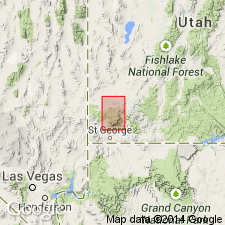
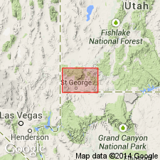
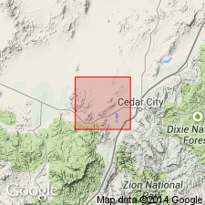
Type locality: Right Quichapa Canyon, in NE/4 of T. 37 S., R. 13 W., Harmony Hills [Harmony Mountains], southeast of Iron Mountain, Iron Springs district, Iron Co., southwestern UT.
Source: Publication; Changes in stratigraphic nomenclature, 1967 (USGS Bull. 1274-A, p. A16); GNU records (USGS DDS-6; Menlo GNULEX).
- Usage in publication:
-
- Quichapa Group*
- Modifications:
-
- Age modified
- Adopted
- AAPG geologic province:
-
- Great Basin province
Summary:
Pg. B10-B11 (fig. 2), B12-B13; see also Anderson and Rowley, 1975, GSA Spec. Paper 160, p. 1-51. Quichapa Group is adopted by the USGS. Quichapa Formation raised in rank; includes (ascending): Leach Canyon Formation (now raised in rank), with its Narrows and Table Butte Tuff Members; Condor Canyon Formation, with its Swett and Bauers Tuff Members; and Harmony Hills Tuff [following Williams, 1967, Univ. Washington PhD dissert.; Cook, 1965, Nevada Bur. Mines Rpt., no. 11]. Age is changed from Oligocene or Miocene --to-- Miocene, based on isotopic K-Ar age determinations of constituent formations (citing Armstrong, 1970, Geochemica et Cosmochimica Acta, v. 34; Fleck and others, 1975, GSA Spec. Paper 160, p. 53-62).
Source: Publication; Changes in stratigraphic nomenclature, 1976 (USGS Bull. 1435-A, p. A86).
- Usage in publication:
-
- Quichapa Group*
- Modifications:
-
- Age modified
- AAPG geologic province:
-
- Great Basin province
Summary:
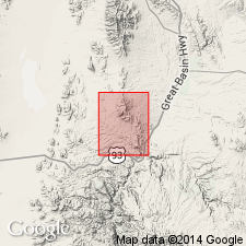
Component formations of the Quichapa Group are mapped east of Antelope Range fault zone in southern Antelope Range in southern and southeastern part of quadrangle, Iron County, southwestern Utah. Mapped formations are (ascending): Leach Canyon Formation (Oligocene), Condor Canyon Formation (Miocene), and Harmony Hills Tuff (Miocene). Age of Quichapa is extended to include Oligocene based on recalculation of radiometric dates from the Leach Canyon Formation. Average isotopic age of Leach Canyon is 24.7 Ma based on three K-Ar ages (recalculated using IUGS decay constants) on biotite, sanidine, and plagioclase by Armstrong (1970), but there is significant variation in the ages (22.9-26.7 Ma).
Source: GNU records (USGS DDS-6; Denver GNULEX).
- Usage in publication:
-
- Quichapa Group*
- Modifications:
-
- Age modified
- AAPG geologic province:
-
- Great Basin province
Summary:
Quichapa Group. Includes (descending): Harmony Hills Tuff, Condor Canyon Formation, and Leach Canyon Formation. Age is extended to include Oligocene on basis of recalculation of isotopic dates for the Leach Canyon Formation.
Source: GNU records (USGS DDS-6; Menlo GNULEX).
For more information, please contact Nancy Stamm, Geologic Names Committee Secretary.
Asterisk (*) indicates published by U.S. Geological Survey authors.
"No current usage" (†) implies that a name has been abandoned or has fallen into disuse. Former usage and, if known, replacement name given in parentheses ( ).
Slash (/) indicates name conflicts with nomenclatural guidelines (CSN, 1933; ACSN, 1961, 1970; NACSN, 1983, 2005, 2021). May be explained within brackets ([ ]).