

- Usage in publication:
-
- "Queen sandstone"
- Queen sand zone
- Modifications:
-
- Revised
- AAPG geologic province:
-
- Permian basin
Summary:
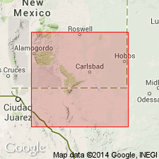
Pg. 972, 983, 987. "Queen sandstone." A sandy limestone and sand zone, 0 to 500 feet thick, notable near old post office at Queen, Eddy County, southeastern New Mexico, is often referred to by New Mexico geologists as "Queen sandstone." The "Queen sandstone" consists primarily of reddish-brown and gray sandstones interbedded with hard gray limestones that are locally sandy. These sandstone lenses lie in uppermost part of San Andres limestone[?], and Queen sand zone is considered the top of that formation. Because there are several of these lenses within 200 feet or more of section the term zone is applicable. These sandstones have been traced from their type locality southwest to El Paso Gap, through Dog Canyon to Bush Mountain (a high mass in the Guadalupes) and south to approximately 5 miles south of New Mexico line and 1 mile northeast of El Capitan. The upper lenses of Queen zone are stratigraphically within 300 feet of top beds of El Capitan. Several miles east of Queen Post Office the Queen outcrop dips steeply north and northeast and is at base of gypsum beds in Carlsbad member. Age is Permian. [In pl. 11 they show Queen sandstone underlying Carlsbad formation, and in one place they say it is very close to stratigraphic position of Frijole limestone. Queen sand zone and Queen sandstone as here used include much more than the Queen sand of Crandall, which outcrops in vicinity of Queen, Eddy County, New Mexico, is 100 feet thick, and, according to W.B. Lang, can be traced 20 or more miles in outcrop.]
Source: US geologic names lexicon (USGS Bull. 896, p. 1755).
- Usage in publication:
-
- Queen sand
- Modifications:
-
- Original reference
- Dominant lithology:
-
- Sandstone
- AAPG geologic province:
-
- Permian basin
Summary:
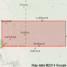
Pg. 929, 940. Queen sand. Brown and buff sandstone, 100 feet thick, underlying Seven Rivers gypsum. Named from extensive outcrops in vicinity of Queen Post Office, in sec. 30, T. 24 S., R. 22 E., Eddy Co., southeastern NM.
F.S. Prout, IN Lloyd, E.R., 1929, AAPG Bull., v. 13, no. 6, p. 656. Queen sand zone to north toward Carlsbad is in top of San Andres limestone[?] and Seven Rivers gypsum is above it.
Source: US geologic names lexicon (USGS Bull. 896, p. 1755).
- Usage in publication:
-
- Queen sandstone member
- Modifications:
-
- Original reference
- Dominant lithology:
-
- Sandstone
- Limestone
- AAPG geologic province:
-
- Permian basin
Summary:
Queen sandstone member of Chalk Bluff formation. Brown and buff sandstone, 100 feet thick, exposed on Queen Mesa, in upper Dark Canyon and along north slope of Hess Hills in Guadalupe Mountains. It underlies Seven Rivers gypsiferous member of Chalk Bluff formation and overlies Dog Canyon limestone. Age is Permian.
[According to Lang (personal communication) his Queen sandstone member corresponds to Queen sand of Crandall, and is the upper sandstone of the thick series of sandstones and limestones which has been called Queen sand, Queen sandstone, and Queen sand zone by the oil geologists, and which includes Dog Canyon limestone of Lang. This is approved definition of the USGS.]
Source: US geologic names lexicon (USGS Bull. 896, p. 1755).

- Usage in publication:
-
- Queen sand†
- Queen sand zone†
- Modifications:
-
- Abandoned
- AAPG geologic province:
-
- Permian basin
Summary:
†Queen sand, †Queen sand zone. See Lang (1937) entry under Queen sandstone member of Chalk Bluff formation.
Source: US geologic names lexicon (USGS Bull. 896, p. 1755).
- Usage in publication:
-
- Queen formation
- Modifications:
-
- Revised
- AAPG geologic province:
-
- Permian basin
Summary:
Pg. 44-49. Queen formation of Whitehorse group. Recognized in subsurface of Andrews, Martin, Dawson, Scurry, and Fisher Counties, western Texas, and Eddy and Lea Counties, southeastern New Mexico. Overlies Grayburg formation and underlies Seven Rivers formation; both of Whitehorse. Age is Permian.
Source: US geologic names lexicon (USGS Bull. 1200, Whitehorse entry p. 4208-4209); supplemental information from GNU records (USGS DDS-6; Denver GNULEX).
- Usage in publication:
-
- Queen Formation
- Modifications:
-
- Revised
- Reference
- Dominant lithology:
-
- Sandstone
- Anhydrite
- AAPG geologic province:
-
- Permian basin
Summary:
Queen Formation of Artesia Group. Sandstone and anhydrite. Overlies Grayburg Formation and underlies Seven Rivers Formation; both of Artesia. Age is Late Permian (Guadalupian).
Reference section (subsurface): depth-interval 1,970 to 2,390 ft, Humble Oil and Refining Company Federal Bogle No. 1 well, in sec. 30, T. 16 S., R. 30 E., Eddy Co., southeastern NM.
Source: Modified from GNU records (USGS DDS-6; Denver GNULEX).
For more information, please contact Nancy Stamm, Geologic Names Committee Secretary.
Asterisk (*) indicates published by U.S. Geological Survey authors.
"No current usage" (†) implies that a name has been abandoned or has fallen into disuse. Former usage and, if known, replacement name given in parentheses ( ).
Slash (/) indicates name conflicts with nomenclatural guidelines (CSN, 1933; ACSN, 1961, 1970; NACSN, 1983, 2005, 2021). May be explained within brackets ([ ]).