


- Usage in publication:
-
- Queen Hill shale bed
- Modifications:
-
- Original reference
- Dominant lithology:
-
- Shale
- AAPG geologic province:
-
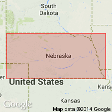
- Nemaha anticline
Summary:
Pg. 44, 46, 47. Queen Hill shale bed of Lecompton limestone member of Shawnee formation. Bluish and argillaceous in upper part, and black, fissile, and somewhat carbonaceous in lower part. Thickness 5 to 5.5 feet in southeastern Nebraska, 6 feet at Folsom, southwestern Iowa, 5 feet north of Amazonia, northwestern Missouri, and 5 to 6 feet south of Atchison, northeastern Kansas. Underlies Cullom limestone [later named Beil limestone and still later abandoned] and overlies Big Springs limestone; all in Lecompton limestone. Age is Late Pennsylvanian (Missouri age). Report includes cross sections, measured sections, geologic maps, stratigraphic tables.
Named from Queen Hill, northeast of Rock Bluff, Cass Co., southeastern NE.
Source: US geologic names lexicon (USGS Bull. 896, p. 1699); GNC KS-NE Pennsylvanian Corr. Chart, sheet 1, Oct. 1936; supplemental information from GNU records (USGS DDS-6; Denver GNULEX).
- Usage in publication:
-
- Queen Hill shale of Condra (1927)
- Modifications:
-
- Revised
- AAPG geologic province:
-
- Nemaha anticline
Summary:
Pg. 11. The so-called Queen Hill shale of [Condra, 1927, Nebraska Geol. Survey Bull., 2nd ser., no. 1], is the Cherryvale shale member.
Source: US geologic names lexicon (USGS Bull. 896, p. 1756); GNC KS-NE Pennsylvanian Corr. Chart, sheet 1, Oct. 1936.
For more information, please contact Nancy Stamm, Geologic Names Committee Secretary.
Asterisk (*) indicates published by U.S. Geological Survey authors.
"No current usage" (†) implies that a name has been abandoned or has fallen into disuse. Former usage and, if known, replacement name given in parentheses ( ).
Slash (/) indicates name conflicts with nomenclatural guidelines (CSN, 1933; ACSN, 1961, 1970; NACSN, 1983, 2005, 2021). May be explained within brackets ([ ]).