The National Geologic Map Database is migrating to a new infrastructure. We apologize for any service disruptions during this process.
|
|---|


- Usage in publication:
-
- Quartzite Peak Quartzite
- Modifications:
-
- Named
- Dominant lithology:
-
- Quartzite
- AAPG geologic province:
-
- Northern Rocky Mountain region
Summary:
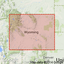
Named as one of five formations of Libby Creek Group probably for Quartzite Peak, Carbon Co, WY, Northern Rocky Mountain region. No type locality designated. Consists of 1,000 m of massive vitreous white orthoquartzite. Very resistant to erosion. Forms distinctive outcrops along North Fork of Encampment River. The quartzite is clean and homogeneous except for a few translucent blue kyanite layers and muscovite zones. Lenticular quartz grains with irregular boundaries make up nearly 100 percent of the formation. Primary bedding and cross-bedding are rare. Conformably overlies Copper Creek Conglomerate (new) of Libby Creek Group. Underlies Slaughterhouse Marble (new), top formation of Libby Creek. Geologic map; mapped with all five formations of the Libby Creek Group. Columnar section. Assigned to the Proterozoic.
Source: GNU records (USGS DDS-6; Denver GNULEX).
For more information, please contact Nancy Stamm, Geologic Names Committee Secretary.
Asterisk (*) indicates published by U.S. Geological Survey authors.
"No current usage" (†) implies that a name has been abandoned or has fallen into disuse. Former usage and, if known, replacement name given in parentheses ( ).
Slash (/) indicates name conflicts with nomenclatural guidelines (CSN, 1933; ACSN, 1961, 1970; NACSN, 1983, 2005, 2021). May be explained within brackets ([ ]).