

- Usage in publication:
-
- Quarry View Park Rhyodacite
- Modifications:
-
- Named
- Dominant lithology:
-
- Rhyodacite
- AAPG geologic province:
-
- Snake River basin
Summary:
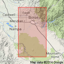
Probably named for park in Boise. Assigned to Miocene Idavada Group (revised). Occurs in northeast margin of western Snake River Plain near Boise, Ada Co, southwestern ID. Exposed as fresh, coarsely phyric glassy rhyodacite vitrophyre from dump of caved adit just south of Castle Rock and east of Quarry View Park 43 deg 36' N and 116 deg 10' W; SE1/4, SW1/4,S12, T3N, R3E; Boise South 7.5' quad. Consists of platy rhyodacite having normal remanent magnetic polarity and displaying degrees of alteration and silicification perhaps related to percolation of geothermal water through area fault systems. The rhyodacite is 20-25% plagioclase, 5% ortho- and clino-pyroxene and primary hornblende, which occur as dark clots (Wood and Burnham, 1983, 1987). Drill core shows presence of basal breccia, which suggests unit is dome or lava flow, not densely welded ash-flow tuff. Thickness is about 35 m. Underlain by 30-m-thick arkosic sand and conglomerate layer and (descending) Miocene (11.3+/-0.3 Ma) Cottonwood Creek Rhyolite (new). Overlain by Miocene (13.5+/-0.9 Ma) Boise basalt volcanic assemblage [informal]. Age is Miocene (11.8+/-0.6 Ma) based on K-Ar analysis of andesine plagioclase and correlates with 9-14 Ma age range shown for Idavada Group in southwestern ID (Armstrong and others, 1980) and (Leeman, 1980). Report includes geologic map and stratigraphic column.
Source: GNU records (USGS DDS-6; Denver GNULEX).
For more information, please contact Nancy Stamm, Geologic Names Committee Secretary.
Asterisk (*) indicates published by U.S. Geological Survey authors.
"No current usage" (†) implies that a name has been abandoned or has fallen into disuse. Former usage and, if known, replacement name given in parentheses ( ).
Slash (/) indicates name conflicts with nomenclatural guidelines (CSN, 1933; ACSN, 1961, 1970; NACSN, 1983, 2005, 2021). May be explained within brackets ([ ]).