The National Geologic Map Database is migrating to a new infrastructure. We apologize for any service disruptions during this process.
|
|---|


- Usage in publication:
-
- Quantico slate*
- Modifications:
-
- Original reference
- Dominant lithology:
-
- Slate
- AAPG geologic province:
-
- Piedmont-Blue Ridge province
Summary:
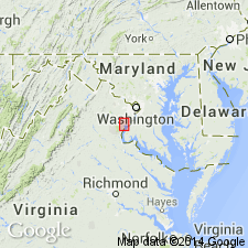
Quantico slate. A narrow belt of black slates [mapped] overlying the crystalline rocks and underlying the Potomac formation. Named for Quantico Creek, [Prince William County], northeastern Virginia. Resembles the roofing slates on James River which carry lower Silurian fossils. [Age is Late Ordovician.]
Source: US geologic names lexicon (USGS Bull. 896, p. 1752).
- Usage in publication:
-
- Quantico slates
- Modifications:
-
- Age modified
- Biostratigraphic dating
- [Principal reference]
- Dominant lithology:
-
- Slate
- AAPG geologic province:
-
- Piedmont-Blue Ridge province
Summary:
Pg. 36-43. Quantico slates. Gray to dark-gray and black slates with beds of green and maroon slates; also contains dense, homogeneous black graphitic slates of fine texture. Laid down at about same time as Martinsburg shale west of Blue Ridge. Age is Late Ordovician (Cincinnatian, probably middle Cincinnatian) based on fossils (pelecypods identifed by R.S. Bassler, Smithsonian USNM).
Named from Quantico Creek, Prince William Co., northeastern VA.
Source: Publication; US geologic names lexicon (USGS Bull. 896, p. 1752).
- Usage in publication:
-
- Quantico slate
- Modifications:
-
- Areal extent
- AAPG geologic province:
-
- Piedmont-Blue Ridge province
Watson, T.L., 1916, Geologic map of Virginia: Virginia Geological Survey
Summary:
[Map explanation of Ordovician (Cincinnatian) block "Includes the Arvonia and Quantico slates of the Piedmont Plateau province."]
Source: US geologic names lexicon (USGS Bull. 896, p. 1752).
- Usage in publication:
-
- Quantico slate
- Modifications:
-
- Areal extent
- AAPG geologic province:
-
- Piedmont-Blue Ridge province
Summary:
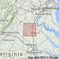
Pg. 159-166. Quantico slate. Occurs in narrow discontinuous belt, rarely more than 1 mile wide, extending for more than 40 miles in a northeast-southwest direction along eastern border of northeastern Piedmont district. Is known to be of Cincinnatian age through work of Watson and Powell, who reported a Cincinnatian fauna from it in Powell's Creek section near Dumfries, Prince William County, [northeastern Virginia]. The slate varies from black graphitic to a gray type closely related to phyllite.
Source: US geologic names lexicon (USGS Bull. 896, p. 1752).
- Usage in publication:
-
- Quantico slate
- Modifications:
-
- Mapped
- Dominant lithology:
-
- Slate
- Rhyolite
- AAPG geologic province:
-
- Piedmont-Blue Ridge province
Nelson, W.A., 1928, [Preliminary edition of geologic map of Virginia]: Virginia Geological Survey
Summary:
Quantico slate is in part of graphitic and includes rhyolite flows in northern areas. Mapped near Quantico, Prince William County, [northeastern Virginia]. Assigned to Ordovician.
Source: US geologic names lexicon (USGS Bull. 896, p. 1752).
- Usage in publication:
-
- Quantico Slate
- Modifications:
-
- Age modified
- Revised
- AAPG geologic province:
-
- Piedmont-Blue Ridge province
Summary:
Quantico Slate of the Glenarm Series is here considered to be Early Cambrian in age based on stratigraphic position. Overlies the Lower Cambrian Chopawamsic Formation. Intruded by the Dale City Quartz Monzonite (new), which is Early Cambrian.
Source: GNU records (USGS DDS-6; Reston GNULEX).
- Usage in publication:
-
- Quantico Formation*
- Modifications:
-
- Revised
- Redescribed
- Age modified
- AAPG geologic province:
-
- Piedmont-Blue Ridge province
Summary:
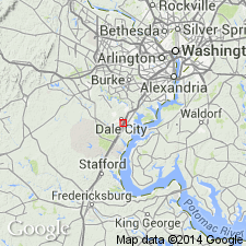
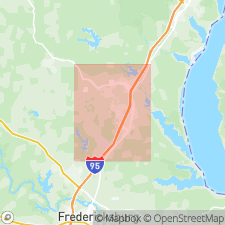
Revised from Quantico Slate to Quantico Formation because the formation in most places is a schist that locally contains quartzitic layers. Also revised in that gneiss, schist, amphibolite, and meta-igneous rocks intruding the Quantico have been named Fredericksburg Complex; Fredericksburg includes newly named Po River and Ta River Metamorphic Suites, Holly Corner Gneiss, and Falls Run Granite Gneiss. Younger intrusive rocks into the Quantico are named Falmouth Intrusive Suite (not a part of Fredericksburg). Late Ordovician age is confirmed by discovery of crinoid stems with star-shaped lumens, a morphological development recognized as present only in Ordovician or younger crinoids. An actinoceroid cephalopod, probably of Ordovician to Silurian age, is also present in same collection. Fossils in Dale City collection are therefore Ordovician or younger. These were found in Quantico near Dale City, VA, about 50 m away from northeast contact with Dale City pluton. In addition, lithologic and stratigraphic similarity of Quantico to Arvonia Slate of Middle to Late Ordovician age in central VA supports Ordovician age. Contact separating Quantico from Dale City pluton is an unconformity, not an intrusive contact. There is now little reason to doubt the authenticity of original fossil collection from the Quantico (made by Watson and Powell in 1911 and since lost, with locality now buried under Interstate Hwy 95) nor the identification by R.S. Bassler of PTERINEA DEMISSA of Late Ordovician age. Furthermore, because an unconformity separates Quantico from Dale City pluton, the approx 560 Ma discordant zircon age for Dale City is no longer consistent with local geology. Dale City pluton and associate pre-Quantico rocks are therefore exposed in strike belt of Quantico, probably in a heretofore unrecognized anticline.
Source: GNU records (USGS DDS-6; Reston GNULEX).
- Usage in publication:
-
- Quantico Formation*
- Modifications:
-
- Age modified
- Biostratigraphic dating
- AAPG geologic province:
-
- Piedmont-Blue Ridge province
Summary:
Fossils from the Dale City locality, under a northeast-trending power line about 185 m northeast from Dale Boulevard, yields crinoids and an actinoceratoid cephalopod indicating an age younger than Cambrian. Regional correlations suggest a Late Ordovician age. In addition, Quantico unconformably overlies Dale City pluton [Occoquan Granite], dated at 560 Ma by zircon methods; this pluton was previously believed to be intrusive. Quantico also is similar to Middle and Late Ordovician Arvonia Slate with which it has long been correlated.
Source: GNU records (USGS DDS-6; Reston GNULEX).

- Usage in publication:
-
- Quantico Formation
- Modifications:
-
- Overview
- AAPG geologic province:
-
- Piedmont-Blue Ridge province
Summary:
Quantico Formation on VA State map is divided into two lithologic units: slate and porphyroblastic schist; and micaceous quartzite. The first is described as gray to black, graphitic, pyritic phyllite and slate in the northern Piedmont. Metamorphic grade increases to the southwest where unit becomes porphyroblastic staurolite-, kyanite-, and garnet-biotite-muscovite schists. Locally unit contains felsic metatuff, metagraywacke, and micaceous quartzite interbeds. Thickness estimated at 3,000 ft. The second lithology, a light-gray, fine- to medium-grained quartzite and quartzose muscovite schist occurs as thin discontinuous lenses at the base of the Quantico. Age is Ordovician.
Source: GNU records (USGS DDS-6; Reston GNULEX).
- Usage in publication:
-
- Quantico Formation
- Modifications:
-
- Mapped
- Dominant lithology:
-
- Slate
- Phyllite
- Schist
- Volcaniclastics
- AAPG geologic province:
-
- Piedmont-Blue Ridge province
Summary:
Quantico Formation. Subdivided into (and separately mapped): black to medium-gray slate, phyllite, and schist; and metamorphosed volcaniclastic rock equivalent to "felsic tuff" of Mixon and others, 1972 (USGS Geol. Quad. Map GQ-1044) and "felsic volcaniclastic member" of Seiders and Mixon, 1981 (USGS Misc. Inv. Map I-1175). Fossils. Carries pelecypods closely related to Late Ordovician PTERINEA (identified by R.S. Bassler, USNM; see Walker and Powell, 1911) and crinoids and cephalopods of Ordovician or younger age (see Pavlides, 1980). Zircons from metamorphosed lapilli tuff layer in lower part of Quantico Formation yielded U-Pb age of 451 +/-6 Ma (citing Horton and others, 1998, GSA Abs. w/ Prog., v. 30, no. 7, p. A125). Age is considered Late Ordovician.
Source: Publication.

- Usage in publication:
-
- Quantico Formation*
- Modifications:
-
- Age modified
- Geochronologic dating
- AAPG geologic province:
-
- Piedmont-Blue Ridge province
Summary:
Pg. 623, 624-625 (geol. map), 629, 631 (fig. 6B), 632 (table 1), 635, 653 [colln. loc. registry]. Quantico Formation. Overlies Chopawamsic Formation; in places contact may be gradational and conformable, or unconformable. Considered correlative with Arvonia Formation. Samples collected from a medium-light-gray, felsic crystal-lithic lapilli metatuff in lower part of Quantico Formation. These rocks were previously mapped as "felsic volcaniclastic member" of Quantico Formation by Seiders and Mixon, 1981 (USGS Misc. Inv. Map I-1175). Zircons yielded U-Pb weighted average age of 448 +/-4 Ma. Age interpreted to be time of eruption of the tuff. Age of lower part of Quantico and upper part of Chopawamsic constrains transition from island-arc volcanism to successor-basin sedimentation at ca. 453 to 448 Ma.
Sampling locality: in unnamed tributary of Neabasco Creek, on south side of Montgomery Ave., north of Opitz Blvd. and between highways I-95 and U.S. 1, about 35 km southwest of Washington, D.C., Lat. 38 deg. 38 min. 14 sec. N., Long. 77 deg. 16 min. 56 sec. W., Occoquan 7.5-min quadrangle, Prince William Co., VA; collected in 1998.
[Age of Quantico and Chopawamsic considered Late Ordovician (Cincinnatian); interpolated from Webby and others, 2004, IN Webby and others, eds., Great Ordovician biodiversification event, Columbia Univ. Press, p. 44 (fig. 2.2).]
Source: Publication.
For more information, please contact Nancy Stamm, Geologic Names Committee Secretary.
Asterisk (*) indicates published by U.S. Geological Survey authors.
"No current usage" (†) implies that a name has been abandoned or has fallen into disuse. Former usage and, if known, replacement name given in parentheses ( ).
Slash (/) indicates name conflicts with nomenclatural guidelines (CSN, 1933; ACSN, 1961, 1970; NACSN, 1983, 2005, 2021). May be explained within brackets ([ ]).