- Usage in publication:
-
- Pysht Formation*
- Modifications:
-
- Named
- Dominant lithology:
-
- Mudstone
- Siltstone
- Conglomerate
- AAPG geologic province:
-
- Olympic Mountains province
Summary:
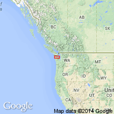
Named for Pysht River which flows into Strait of Juan de Fuca at Pillar Point. Is upper formation of Twin River Group. Type locality designated at shore-cliff exposures along 18 km of Juan de Fuca from Pillar Point State Park, center sec.10 T31N R11W east to point 3.5 km west of Low Point SW/4 sec.19 T31N R9W, Clallam Co, WA. Consists of gray to olive-gray massive mudstone, sandy siltstone, with conglomerate and sandstone interbeds. Contains conglomerate and sandstone channels and lenses, calcareous concretions, and is fossiliferous. Thickness ranges from 1,100 to 1,400 m. Gradationally, or locally unconformably, overlies Makah Formation (new) (Twin River Group); gradationally underlies Clallam Formation. Age is late Oligocene and early Miocene (Zemorrian and Saucesian).
Source: GNU records (USGS DDS-6; Menlo GNULEX).
For more information, please contact Nancy Stamm, Geologic Names Committee Secretary.
Asterisk (*) indicates published by U.S. Geological Survey authors.
"No current usage" (†) implies that a name has been abandoned or has fallen into disuse. Former usage and, if known, replacement name given in parentheses ( ).
Slash (/) indicates name conflicts with nomenclatural guidelines (CSN, 1933; ACSN, 1961, 1970; NACSN, 1983, 2005, 2021). May be explained within brackets ([ ]).

