

- Usage in publication:
-
- Pybus Dolomite*
- Modifications:
-
- Named
- Biostratigraphic dating
- Dominant lithology:
-
- Dolomite
- Chert
- AAPG geologic province:
-
- Alaska Southeastern region
Summary:
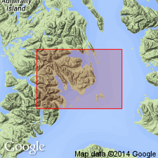
Named for exposures along shores of Pybus Bay, Admiralty Island, southeastern AK, which is designated type locality. Best sections are on peninsula 1.2 mi west of Long Island on southwest shore of Pybus Bay. Composed of light brownish-gray fossiliferous cherty dolomite. Measured section at 3 mi northwest of triangulation station "Dro" is 437 ft thick; section 2.5 mi N 10 deg W of station "Dro" is 215 ft thick. Overlies Cannery Formation (new); underlies Hyd Formation (new). Fossil list (identified by J.T. Dutro, Jr.) and localities included in paper. Age is Permian.
Source: GNU records (USGS DDS-6; Menlo GNULEX).
- Usage in publication:
-
- Pybus Formation*
- Modifications:
-
- Redescribed
- Areal extent
- AAPG geologic province:
-
- Alaska Southeastern region
Summary:
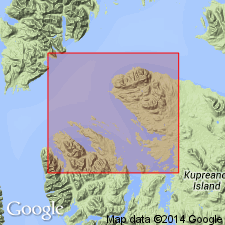
Shown on geologic map of Keku Islets and neighboring parts of Kuiu and Kupreanof Islands, southeastern AK. Because unit is dominantly limestone in Keku Strait area and everywhere contains abundant chert, name is herein changed to Pybus Formation. Conformably overlies Halleck Formation (new) on Kuiu Island and Keku Islets. On Kupreanof Island appears to conformably overlies Cannery Formation. On Kuiu Island unit disconformably underlie Keku Volcanics (new) and in Keku Islets and east of Keku Strait underlies Burnt Island Conglomerate (new). Age given as Permian.
Source: GNU records (USGS DDS-6; Menlo GNULEX).
- Usage in publication:
-
- Pybus Formation*
- Modifications:
-
- Age modified
- AAPG geologic province:
-
- Alaska Southeastern region
Summary:
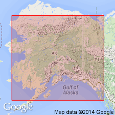
Correlation chart of Permian strata in AK shows Pybus Formation contains Kungurian (Early Permian) corals, [thus age of unit is Early Permian].
Source: GNU records (USGS DDS-6; Menlo GNULEX).
For more information, please contact Nancy Stamm, Geologic Names Committee Secretary.
Asterisk (*) indicates published by U.S. Geological Survey authors.
"No current usage" (†) implies that a name has been abandoned or has fallen into disuse. Former usage and, if known, replacement name given in parentheses ( ).
Slash (/) indicates name conflicts with nomenclatural guidelines (CSN, 1933; ACSN, 1961, 1970; NACSN, 1983, 2005, 2021). May be explained within brackets ([ ]).