The National Geologic Map Database is migrating to a new infrastructure. We apologize for any service disruptions during this process.
|
|---|


- Usage in publication:
-
- Punta de la Mesa sandstone
- Modifications:
-
- First used
- Dominant lithology:
-
- Sandstone
- AAPG geologic province:
-
- San Juan basin
Summary:
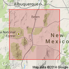
First published use of name. Intent to name, source of geographic name, and type locality not stated. Briefly described in a sequential listing of Cretaceous rocks in the valley of Rio Puerco, Valencia Co, NM, San Juan basin, as a 25 to 50 ft thick fossiliferous sandstone. Occurs above an unnamed shale and flag unit about 100 ft thick and below an unnamed shale 80 to 100 ft thick. Geologic map.
Source: GNU records (USGS DDS-6; Denver GNULEX).
- Usage in publication:
-
- Punta de la Mesa sandstone member*
- Modifications:
-
- Revised
- AAPG geologic province:
-
- San Juan basin
- Estancia basin
Summary:
Revised "at its type locality" [none specified by Herrick, 1900] in the Rio Puerco field, Valencia Co, NM, San Juan basin [from a formation or an unranked unit?] to the lowest member of the Mesaverde formation. Identified in a measured section at Tijeras, Bernalillo Co, NM in the Estancia basin, as a 77 ft thick massive sandstone. Overlies Mancos shale. Underlies unnamed part of Mesaverde. Assigned to Montana group and to the Cretaceous system. Stratigraphic table.
Source: GNU records (USGS DDS-6; Denver GNULEX).
For more information, please contact Nancy Stamm, Geologic Names Committee Secretary.
Asterisk (*) indicates published by U.S. Geological Survey authors.
"No current usage" (†) implies that a name has been abandoned or has fallen into disuse. Former usage and, if known, replacement name given in parentheses ( ).
Slash (/) indicates name conflicts with nomenclatural guidelines (CSN, 1933; ACSN, 1961, 1970; NACSN, 1983, 2005, 2021). May be explained within brackets ([ ]).