


- Usage in publication:
-
- Pungo River Formation*
- Modifications:
-
- Named
- Dominant lithology:
-
- Sand
- Silt
- Clay
- Limestone
- AAPG geologic province:
-
- Atlantic Coast basin
Summary:
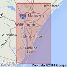
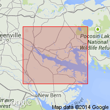
Pungo River Formation is here named in the subsurface near Belhaven, Beaufort Co., NC. Unit is composed of interbedded phosphatic sands, silts, and clays, diatomaceous clays, and phosphatic and nonphosphatic limestones. Dips gently to east in Beaufort Co. Thickness ranges from a featheredge a few mi east of Washington to more than 110 ft in southeastern part of county. Occurs between depth of 224 and 276 ft in type core. Unconformably overlies Castle Hayne Limestone; unconformably underlies Yorktown Formation. Age is middle Miocene.
Source: GNU records (USGS DDS-6; Reston GNULEX).
- Usage in publication:
-
- Pungo River Formation*
- Modifications:
-
- Age modified
- AAPG geologic province:
-
- Atlantic Coast basin
Summary:
USGS accepted age at this time is middle Miocene, but late Oligocene or early Miocene is not ruled out.
Source: GNU records (USGS DDS-6; Reston GNULEX).
- Usage in publication:
-
- Pungo River Formation*
- Modifications:
-
- Areal extent
- AAPG geologic province:
-
- Atlantic Coast basin
Summary:
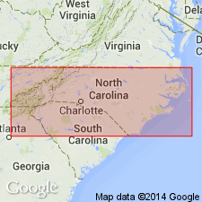
Pungo River Formation, undivided, extended into southeastern VA from eastern NC. Its members, Belhaven and Bonnerton, are not extended or mapped in VA. Pungo River extension now geographically restricts Calvert Formation from southeastern VA.
Source: GNU records (USGS DDS-6; Reston GNULEX).
- Usage in publication:
-
- Pungo River Formation*
- Modifications:
-
- Revised
- AAPG geologic province:
-
- Atlantic Coast basin
Summary:
Advance copy (1978). Pungo River Formation. Divided into (ascending) lower and middle Miocene Belhaven Member and middle Miocene Bonnerton Member. Unconformably overlies Castle Hayne Formation; unconformably underlies Yorktown Formation.
Source: Modified from GNU records (USGS DDS-6; Reston GNULEX).

- Usage in publication:
-
- Pungo River Formation*
- Modifications:
-
- Age modified
- AAPG geologic province:
-
- Atlantic Coast basin
Summary:
Advance copy (1976). Age changed from middle Miocene --to-- late early and early middle Miocene. [This manuscript was reviewed by the GNU in May, 1976.]
Source: Modified from GNU records (USGS DDS-6; Reston GNULEX).
- Usage in publication:
-
- Pungo River Formation
- Modifications:
-
- Geochronologic dating
- AAPG geologic province:
-
- Atlantic Coast basin
Summary:
The material analyzed in this study consisted of long-ranging, nondiagnostic fossil shells and sandy, glauconitic limestones. Phosphatic materials gave inconsistent results. The age of deposition for each unit was assigned by comparing 87Sr/86Sr results with the seawater strontium curve. The Pungo River was sampled from one quarry in the Aurora area. Eleven samples were analyzed from the upper part of the unit and when the results were compared with the strontium seawater line, they indicated an age near the early-middle Miocene boundary. Paleontologic data indicate that deposition of the Pungo River began about 19 Ma and continued for about 6 million years.
Source: GNU records (USGS DDS-6; Reston GNULEX).

- Usage in publication:
-
- Pungo River Formation*
- Modifications:
-
- Overview
- AAPG geologic province:
-
- Atlantic Coast basin
Summary:
Pungo River Formation is composed of cyclical deposits of phosphatic clays and sands and carbonates. It is subdivided in the Aurora district into four informal stratigraphic units. Units A through C show similar succession of sediment types--a predominantly terrigenous sand grading upward into phosphorite sand capped by variably indurated carbonates, dolomitic in Units A and B and calcitic in Unit C. All three are muddy throughout. Unit D, which caps the Pungo River sequence, is slightly phosphatic, sandy, bioclastic-rich dolosilt. Fossil fragments are largely barnacles and bryozoans. All four units occur in the eastern portion of the Aurora district, but only A and B are present to the west near the updip limit of the formation. Disconformably overlies the Eocene Castle Hayne Formation and underlies the Pliocene Yorktown Formation. Age of the Pungo River is early to middle Miocene.
Source: GNU records (USGS DDS-6; Reston GNULEX).
For more information, please contact Nancy Stamm, Geologic Names Committee Secretary.
Asterisk (*) indicates published by U.S. Geological Survey authors.
"No current usage" (†) implies that a name has been abandoned or has fallen into disuse. Former usage and, if known, replacement name given in parentheses ( ).
Slash (/) indicates name conflicts with nomenclatural guidelines (CSN, 1933; ACSN, 1961, 1970; NACSN, 1983, 2005, 2021). May be explained within brackets ([ ]).