

- Usage in publication:
-
- Pumpkin Creek member
- Modifications:
-
- Named
- Dominant lithology:
-
- Limestone
- Shale
- AAPG geologic province:
-
- South Oklahoma folded belt
Summary:
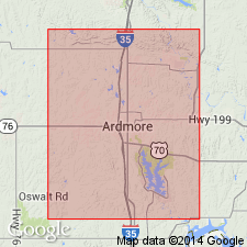
Pg. 33-34. Uppermost member of Dornick Hills formation is designated Pumpkin Creek limestone, from excellent outcrops on Pumpkin Creek, in SE/4 sec. 19, T. 6 S., R. 3 E. The upper limestones of Dornick Hills are also well exposed in secs. 10 and 15, T. 6 S., R. 2 E., where main part of Pumpkin Creek member forms a strong topographic ridge and reaches thickness of 70 feet, including 20 feet of shaly beds. Its limestone strata here vary from medium- to coarse-grained, pure to sandy, nearly barren to quite fossiliferous. Most distinctive type, which is found also on other side of Overbrook anticline in N/2 sec. 7, T. 6 S., R. 2 E., and in nearly all outcrops of this member between there and Dornick Hills (north of Ardmore), is a very coarsely granular cross-bedded, rather sandy gray limestone which weathers to a sort of coarse gray calcitic sand. About 150 feet below the main Pumpkin Creek limestone on south line of sec. 10, T. 6 S., R. 2 E., occurs another bed of fossiliferous limestone only 2 feet thick. Between the two are some very fossiliferous shales in which the cavities in some of the shells, especially crinoid stems and high-turreted gastropods, are filled with bluish chert. Disk-shaped masses of siliceous (sponge?) spicules, the disks up to 2.5 inches in diameter, constitute a unique element in this fauna. 400 or 500 feet lower in section, at same locality, occurs a 15-foot stratum of lumpy, chalky limestone closely interbedded with chalky shales, all highly fossiliferous. This type of rock occurs in much closer association with main Pumpkin Creek ledge north of Ardmore, where it has been mapped as part of that member, and is probably the bed mentioned by Goldstein as carrying CAMPOPHYLLUM TORQUIUM, near top of his Cup Coral member. It weathers in many places to white chalky soil, full of a great abundance and variety of easily collected fossils, including large cup corals. On south line of sec. 10, T. 6 S., R. 2 E., the main ledge of Pumpkin Creek member occurs about 2,000 feet above Bostwick member. This interval diminishes rapidly northwestward, with especially pronounced convergence in secs. 4 and 5, T. 6 S., R. 2 E.; north and west of Ardmore it is only 900 to 1,000 feet. Age is Pennsylvanian.
Source: GNU records (USGS DDS-6; Denver GNULEX).
For more information, please contact Nancy Stamm, Geologic Names Committee Secretary.
Asterisk (*) indicates published by U.S. Geological Survey authors.
"No current usage" (†) implies that a name has been abandoned or has fallen into disuse. Former usage and, if known, replacement name given in parentheses ( ).
Slash (/) indicates name conflicts with nomenclatural guidelines (CSN, 1933; ACSN, 1961, 1970; NACSN, 1983, 2005, 2021). May be explained within brackets ([ ]).