The National Geologic Map Database is migrating to a new infrastructure. We apologize for any service disruptions during this process.
|
|---|


- Usage in publication:
-
- Pueblo Creek Formation*
- Modifications:
-
- Named
- Dominant lithology:
-
- Andesite
- Breccia
- Sandstone
- Conglomerate
- Tuff
- AAPG geologic province:
-
- Basin-and-Range province
Summary:
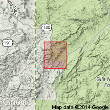
Named as upper formation of Datil Group for Pueblo Creek, Bull Basin and Saliz Pass quads, Catron Co, NM, Basin-and-Range province. Replaces terms such as "early andesitic volcanic sequence". Is nearly, but not exactly, equivalent to Spears Formation of northeastern part of Mogollon-Datil volcanic field and to Rubio Peak Formation of southeastern part of field. Type area extends from Aspen Mountain, Bull Basin quad, to about 2 km south of mouth of Bear Canyon, Saliz Pass quad. Upper contact is a regional erosional unconformity with Oligocene Davis Canyon Tuff. Intertongues with Oligocene tuff of Bishop Peak?. Lower contact is with [Eocene] Baca Formation. Seven units mapped: 1) volcaniclastic rocks--about 200 m thick of well-rounded cobble and boulder beds of Paleozoic limestone and Precambrian gneiss and granite, pyroclastic fallout and ash beds; 2 and 3) andesite flows--gray, porphyritic; those at Saddle Mountain have a K-Ar plagioclase age of 33.3 +/-1.2 m.y. and are 60 m thick; those at Dry Leggett Canyon are 200-300 m thick; 4) andesite dike; 5) andesitic lava flows; 6) vent facies--ropy scoriaceous glassy breccia; 7) alluvial facies--maroon to pink interlayered volcaniclastic debris flows, conglomerates and sandstones 300 to 350 ft thick. Several tuffs interbedded, but considered separate from Pueblo Creek. Tuff t3 has a K-Ar age of 31.9 +/-0.7 m.y. Oligocene age.
Source: GNU records (USGS DDS-6; Denver GNULEX).
For more information, please contact Nancy Stamm, Geologic Names Committee Secretary.
Asterisk (*) indicates published by U.S. Geological Survey authors.
"No current usage" (†) implies that a name has been abandoned or has fallen into disuse. Former usage and, if known, replacement name given in parentheses ( ).
Slash (/) indicates name conflicts with nomenclatural guidelines (CSN, 1933; ACSN, 1961, 1970; NACSN, 1983, 2005, 2021). May be explained within brackets ([ ]).