

- Usage in publication:
-
- Promontory Member*
- Modifications:
-
- Named
- Dominant lithology:
-
- Volcaniclastics
- AAPG geologic province:
-
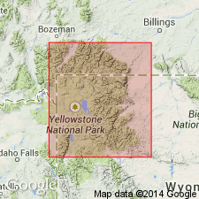
- Yellowstone province
Summary:
Named as a member of Langford Formation (new) of Absaroka Volcanic Supergroup (new). The type area and source of the unit name is The Promontory, a peninsula separating the Southeast Arm from the South Arm of Yellowstone Lake, Yellowstone National Park, Yellowstone province, WY. Is restricted to southeast part of Park. Name is applied to several eastward-thinning tongues of dark, massive volcanic conglomerate and breccia interbedded with the light-colored andesitic volcaniclastic strata of Langford. Is about 600 ft thick in type area. Recognized in the northeast, eastern, and southeastern parts of the Park. Assigned an early middle Eocene age based on stratigraphic position of Langford between two dated formations: Trout Peak Trachyandesite (new, below) and Two Ocean Formation (new, above).
Source: GNU records (USGS DDS-6; Denver GNULEX).
For more information, please contact Nancy Stamm, Geologic Names Committee Secretary.
Asterisk (*) indicates published by U.S. Geological Survey authors.
"No current usage" (†) implies that a name has been abandoned or has fallen into disuse. Former usage and, if known, replacement name given in parentheses ( ).
Slash (/) indicates name conflicts with nomenclatural guidelines (CSN, 1933; ACSN, 1961, 1970; NACSN, 1983, 2005, 2021). May be explained within brackets ([ ]).