- Usage in publication:
-
- Promised Land Formation*
- Modifications:
-
- Named
- Dominant lithology:
-
- Gneiss
- Amphibolite
- Quartzite
- Schist
- AAPG geologic province:
-
- Piedmont-Blue Ridge province
Summary:
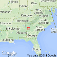
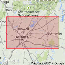
The Promised Land Formation of the Atlanta Group, here named in the Newnan-Tucker synform near Atlanta, GA, consists of interlayered gneiss and amphibolite in the lower part and the Hannah Member, consisting of quartzite and schist at the top. It is in gradational contact with the Wolf Creek Formation, in sharp conformable contact with the Clairmont Formation, and in sharp, probably tectonic contact with the Lithonia Gneiss. Thickness is 400 to 1,500 m. Age is Late Proterozoic and (or) early Paleozoic.
Source: GNU records (USGS DDS-6; Reston GNULEX).

- Usage in publication:
-
- Promised Land Formation*
- Modifications:
-
- Revised
- AAPG geologic province:
-
- Piedmont-Blue Ridge province
Summary:
The Promised Land Formation is removed from the Atlanta Group, here abandoned. The Hannah Member of the Promised Land is abandoned, having been discovered to be a mylonite along the Hannah thrust fault at the base of the Promised Land, which comprises the Promised Land thrust sheet occupying the axial area of the Newnan-Tucker synform, where it has been thrust upon the Clarkston and Big Cotton Indian Formations of the Clarkston slice of the Atlanta thrust sheet. It consists of interlayered metamorphosed felsic tuffs and amphibolites and bodies of granitic gneisses. Age is Late Proterozoic to Early Ordovician(?).
Source: GNU records (USGS DDS-6; Reston GNULEX).

- Usage in publication:
-
- Promised Land Formation†
- Modifications:
-
- Abandoned
- AAPG geologic province:
-
- Piedmont-Blue Ridge province
Summary:
Detailed mapping of the area underlain by Promised Land Formation indicates that it is actually a variety of Lithonia Gneiss. Promised Land Formation is therefore abandoned and its rocks assigned to Lithonia Gneiss as its gneiss with amphibolite facies. Report includes geologic map and correlation chart.
Source: GNU records (USGS DDS-6; Reston GNULEX).
For more information, please contact Nancy Stamm, Geologic Names Committee Secretary.
Asterisk (*) indicates published by U.S. Geological Survey authors.
"No current usage" (†) implies that a name has been abandoned or has fallen into disuse. Former usage and, if known, replacement name given in parentheses ( ).
Slash (/) indicates name conflicts with nomenclatural guidelines (CSN, 1933; ACSN, 1961, 1970; NACSN, 1983, 2005, 2021). May be explained within brackets ([ ]).

